Tuesday, 26 September 2017

Only those who will risk going too far can possibly find out how far they can go. TS Elliot 

<Author Gerry O'Boyle>


Saturday 16 September 2017


Stage Eight: Donaghadee to Belfast (43k or 27miles)


This was our final Co. Down stage in very familiar territory. Sean is from Donaghadee and both Helen and I live in Bangor so the three of us knew exactly where we were going today. We hadn’t to worry about the tide either as we had a proper coastal path almost all of the way to Belfast. We were running from east to west today with a nice view across to the south Antrim coast and Scotland (Dumfries and Galloway) clearly visible in the distance

Today’s starting team

Our main team of three (Helen, Sean and I) met at 7.15 am at Donaghadee Lighthouse (where we finished on 12 Aug) and we were delighted to be joined once again by Sarah, Claire and Jill. Also we welcomed five new first-timers today, Melanie Patton, Donald Smith, Johnny McGrath, Michael Roberts and Lynne Kerr.


Melanie has been such a good supporter of ours, ever since we came up with this crazy idea last October. Donald is another ultra-marathon runner, having recently completed 100 miles in a 24 hour challenge! Johnny is founder of the Sunday Morning Running/Coffee group -not sure if Johnny or I will make it tomorrow morning! Michael is a dedicated coach with North Down AC and has worked with and encouraged runners of all ages over the years. Lynne is another dedicated NDAC Coach and trains various groups of runners on Monday and Wednesday nights. So that’s eleven runners today and ten of us started in Donaghadee. Lynne joined us later in Bangor.    
  
Donaghadee

Two very famous songwriters/poets both referred to Donaghadee in their songs, although neither of them has actually been here! Johnny Cash mentions Donaghadee in his ‘Forty Shades of Green’ and the great Thomas Hardy wrote as follows:

I've never gone to Donaghadee,
That vague far townlet by the sea;
In Donaghadee I shall never be:
Then why do I sing of Donaghadee,


Another famous writer Brendan Behan painted the Lighthouse and I don’t mean drew a picture of it! He was responsible for maintaining it and by all accounts failed miserably at his task! Remember we passed St. John’s Point in May (Stage 4) and referred to Behan too – see earlier blog.

Once again we were mostly lucky with the weather. It seems like it’s been raining every day since July but we had a nice bright sky for most of the day. It was  a nice clear morning too and we could easily see the Scottish coast and the famous Mull of Kintyre, about 40 miles away in the distance.

We depart from the village of Donaghadee at about 7.30am.

We run along the main coastal road towards Bangor but after about 2.5 miles (at the car park and opposite the Portavoe Reservoir) we go through a gate/gap in the fence and find a narrow coastal path. Shortly afterward we climb steep steps and now we are running on the edge of a low cliff with the Copeland Islands so close on our right hand side. We are really in the townland of Orlock now. We follow this path on the edge of the sea, descend some steps and then shortly go through a narrow tunnel which has been cut through the rocks.

Lingering beneath the tunnel hoping that rocks don't fall!

Jill and Michael leading the run towards Orlock
Keeping the sea on the right!

Groomsport & The Eagle Wing


We eventually arrive in the small harbour village of Groomsport -home to the famous Eagle Wing Ship that didn’t quite make it to America. The boat set sail in 1636 and had already completed three-quarters of the journey to America (in the strong winds and storms) when Captain/Reverend Blair decided to turn back.  Reverend Blair saw the extreme weather as a sign of God telling him (and all on board) to return to Ireland. The Boat is still remembered in Groomsport ‘s annual Eagle Wing festival.


Jill, Sean & Melanie leading us through Groomsport
Groomsport harbour
Continuing along the coastal path from Groomsport we shortly arrive on the long Ballyholme Beach (so familiar to us all). It was probably just as well we didn’t have to worry about the tide today as it was almost high tide when we got to Ballyholme. Still there was enough room to run on the edge of the beach and later on Ballyholme Esplanade. We leave Ballyholme beach and follow the coast along a quiet road (Seacliff Road) running on the footpath into Bangor town centre.

Seacliff Road and Bangor skyline from Ballyholme Beach
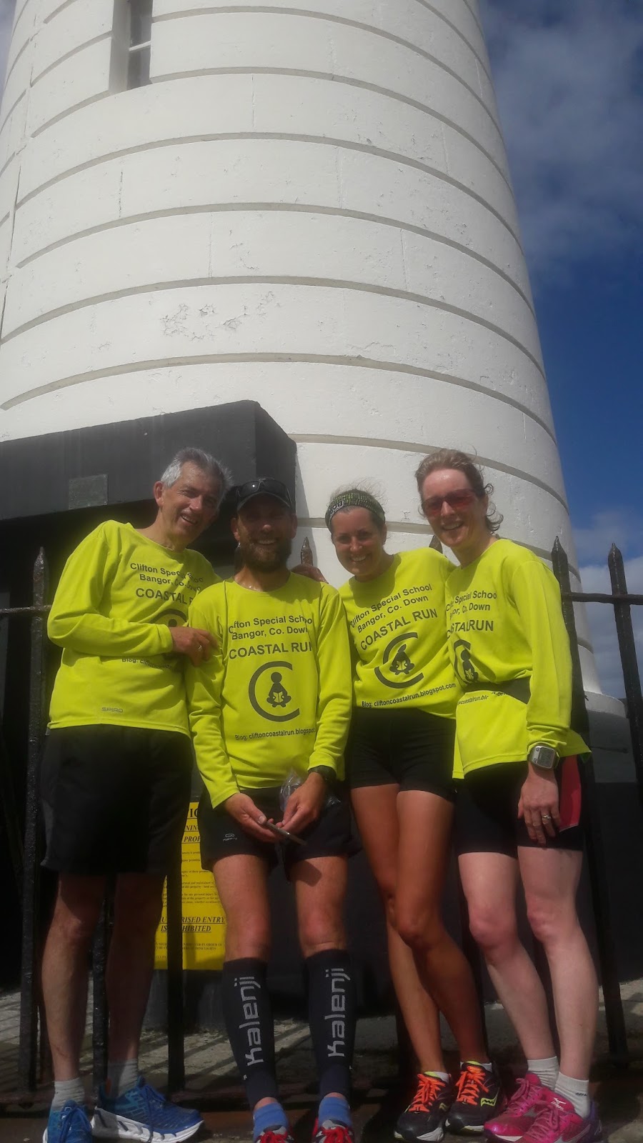
Gerry, Sean & Helen back where it began!
 
Shortly we pass by Eisenhower Pier and are reminded of Bangor’s connection to WW2. Eisenhower visited here to review the troops and ships gathered in Bangor Bay prior to launching D-Day landings in 1944.

Jill is struggling with a hamstring injury but Jill being Jill, keeps going all the way to Bangor. So, the ten of us arrive at Ward Park in Bangor at about 9.15 just in time to run the Bangor parkrun.

Bangor parkrun

There are now 86 different parkruns on the island of Ireland and the numbers are growing all the time! Bangor parkrun, with an average of 259 runners every week (one week there was 420) is the most popular parkrun in N.Ireland and excluding Dublin, Bangor is the most popular parkrun in all of Ireland. To date, over 5,350 different people have completed Bangor’s parkrun in just over 3 years.
Don't forget your barcode!

Gerry running at Bangor parkrun


We get a nice welcome from everyone at the parkrun and we’ve already completed 13 miles this morning. After we finish the parkrun we are treated to a great spread of tea, buns, biscuits and cakes by Alison, Debbie, Brenda and their team.
Very appreciative of the catering at our half way point
 Cannon Gun from U-boat U19 at Ward Park

The Cannon in Ward Park was the main gun on the German U-19 U-boat during WW1. After the surrender of the U-boat in 1918, the Cannon was donated to Bangor in recognition of Commander Bingham VC (who was born in Bangor). Interestingly the German Captain of the U-boat, Weisbach had previously served as torpedo officer on the U-boat that sank the Lusitania in 1915 (which was really the deciding factor in American entering WW1) Also, during his brief command of the U-19, Herr Weisbach delivered Sir Roger Casement from the U19 U-boat to Banna Strand in Co. Kerry in April 1916. The knighted Casement, who had switched allegiance to the Irish cause, was captured shortly after arriving on the Kerry beach and hanged for treason in June 1916.
Ward Park Cannon - this marks the start of the Bangor parkrun
Jill, Sarah, Melanie, Johnny, Donald and Michael leave us at Bangor but Claire continues with the regular three (Helen, Sean and I). We then welcomed Lynne Kerr who joined us at Bangor and so now there are five of us. 

At the McKee Clock in Bangor we also meet up with some other Clifton parents (Janis & friends, and the Nickell family too) who are walking from Bangor to Holywood. Maureen and our son Brian also walk with us for a short while.
10.30am meeting at McKee Clock, Bangor

Gerry, Brian & Maureen lead out the Clifton coastal walkers
At the Pickie Park in Bangor, we leave the walkers and the five of us continue running along the coastal path. We really enjoyed today, passing all those familiar and beautiful places that we’ve walked and run so many times, Strickland’s Glen, Crawfordsburn and Helen’s Bay (named after Helen Blackwood aka Lady Dufferin)

Taking the easy route - the Pickie Puffer!
Running along the N. Down coastal path, we pass by a lot of golf courses here. Of course our own local hero, Rory McIlroy (from nearby Holywood) learned his trade here. We get a nice surprise at Cultra when Michael Stitt, our colleague from NDAC comes to meet us and cheer us on.
Claire, Lynn, Sean, Gerry and Helen at the new bridge at Seahill
 
Lynn, Claire, Michael, Gerry, Sean & Helen near Cultra
We arrive in Holywood at about 12.15 and sadly Claire and Lynn leave us here. These two girls have really kept us going along the N.Down coast. And so, only the three people who started this great adventure back in February get to finish the final few miles of the Co. Down coastal run. We stay by the coast at the Dirty Duck pub, following a narrow, traffic free road and eventually we arrive at a big office building (Clare House) on the outskirts of Belfast at Airport Road West. We’re obviously very near George Best City Airport now and are very much aware of low flying aircraft coming in to land.

Farewell to Claire and Lynn at the Dirty Duck, Holywood
We continue along Airport Road West towards Belfast. Is this the longest road in N.Ireland or did it just feel like that? We’re tiring now too, the bright sky has disappeared and the rain is coming down. Helen and Sean give me some encouragement by announcing that we’ve now done exactly 200 miles of our run! We can now see the famous Harland & Wolff yellow cranes towering in the distance (known locally as Samson and Goliath) these mark the spot where the great Titanic was built in 1912 although the cranes weren't erected until 1974 and 1969 respectively.
One of the famous yellow cranes in Belfast - some 100m high!

Turbine assembly plant at the Belfast Docks
(diameter bigger than the London eye!)

Of course the Co.Down border is geographically the River Lagan and soon we arrive by the river at the fabulous new Titanic Building. The rain is coming down now, it’s turned out to be miserable day, but Helen, Sean and I are so delighted and relieved to have finally got to Belfast. As an extra bonus, Helen has arranged with her friend Ruth Cleland (who works at Titanic) to take us up to the very top of the Titanic Building where we get amazing views of the river Lagan and Belfast. This was definitely the perfect place to finish our Co. Down coastal challenge but the adventure continues........              

 
FINISHED!! At the Iconic Titanic Building

The Bridge in the Titanic Building


PS.  Yes the rumours are true! We’re going to continue and try to complete the whole N.Ireland coast over the next six months.  

Total distance to date: 325k or 203miles      

Next leg (start of Co. Antrim stage): Belfast to Islandmagee: Saturday 7 October


If you’d like to Donate to Clifton Special School, please see below.


Wednesday, 16 August 2017

Nana-korobi, ya-oki 
       (Fall down 7 times, get up 8 times). 

<Author: Gerry O'Boyle>

Saturday 12th August 2017

Stage Seven: Portaferry to Donaghadee (approx 53k or 33miles)


We continued our challenge today, starting in the village of Portaferry and now running along the east side of the Ards Peninsula. I deliberately used that word ‘challenge’ (rather than adventure) because sometimes we forget how hard this task can be.

Today’s starting team
Our main team of three (Helen, Sean and I) were delighted to be joined once again by Claire Garrad & Philip Mulligan and also Sarah Benton who is with us again for the third time. We welcome especially Lindsay Doulton who joins us for the first time. Lindsay is a regular parkrunner, a Fulham supporter and despite now being a young mother, still hasn’t lost any of her fitness.
Starting team at Portaferry


It was an early start, leaving Portaferry at 7.45am. This was so we can make the most of the low tide and the lovely sandy beaches on this part of Co. Down. Today it seemed as if we were running all day long on mostly sandy surfaces and it gives me another excuse too to quote those lovely lines from De Profundis by Oscar Wilde ‘’the sea was for the swimmer, and the sand for the feet of the runner’’. 

We had some sunshine and rain during the morning but not really a lot of either. Still, it was a perfect day for running, never reaching more than 17 degrees and with only a slight north wind blowing in the faces of the seven of us.   

Anyway, we leave Portaferry and run south (yes South, as we’re heading towards Ballyquintin Point at the very bottom of the Ards Peninsula). Remember, we’re rigidly following the coast. It’s a lovely quiet country road from Portaferry and after about 3 miles we see a National Trust road/lane on the right leading back down towards the coast. We’re at Bar Hall Bay now and we stick to the coast even when the lane/path fades away. The path leads us to the very bottom tip of the Ards Peninsula at Ballyquintin and shortly we ‘turn the corner’ and head north now with the Irish sea on our right hand side. At Ballyquintin Point we find a lovely grassy path which we follow for a mile or two. The seven of us have the whole world to ourselves here and we haven’t seen anyone else since we left Portaferry. However, after a while our grassy path disappears and suddenly we’re clambering through a rough area of sinking soft grass, trying to avoid the nettles. 
Gerry and Claire at Ballyquintin Point
Scrambling through the nettles


In the distance we see a cornfield and when we reach the field we notice a very narrow path which guides us nicely through the cornfield without causing any damage to the crop. We eventually leave the cornfield and come back onto a country road passing lovely secluded beaches at Millin Bay and later at Knockinelder. The tide is out fully now so we drop down to the expansive Knockinelder beach running onto the strand and staying on the shoreline.  Just after Knockinelder, we pass a beautiful showpiece village called Kearney which has been restored by the National Trust. There is evidence of life and activity here going back over a thousand years and the old Slans Graveyard is nearby. The village of Kearney itself was used recently as a setting for a film ‘My Mother and Other Strangers’ set in WW2.    


Sean, Gerry and Claire at Kearney

Cloughey and Portavogie

Cloughey Beach
To travel by road by Portaferry to Cloughey is 5 miles but it took us (strictly coastal runners) 14.5 miles to get here. It’s another beautiful and long beach at Cloughey and with the low tide, perfect for the feet of us runners.

Gerry and Claire silhouetted at Cloughey Beach
Much like a cat among the pigeons - Philip among the seagulls!
Farewell to Lindsay and Claire at Cloughey

We are sad to say goodbye to Lindsay and Claire and now there are five of us left. We continue through the sand dunes and bushes at Cloughey. Even though it’s still early August, we notice the blackberries are already ripe.


Losing Philip in the high ferns!


At Portavogie they’re getting ready for a Seafood Festival here but unfortunately we haven’t time to wait. Also at Portavogie, we should note that in his later years Georgie Best and his wife Alex moved here for a much quieter life.


shipwreck on Portavogie beach
 Just north of Portavogie we pass Burr Point, the most easterly point on the island of Ireland. Looking out to sea in the distance we can the Isle of Man towards our right and Scotland on our left. Sean also points out the mountains straight across in Cumbria (Lake District) which we can just about make out.

Gerry going west!

Sean, Philip, Helen and Sarah at Burr Point


Remembering Lisa
Next we come to the village of Ballyhalbert and as we run along the beautiful strand opposite the many caravan sites we are reminded of a tragic day over twelve years ago. The day was 28 February 2005 when a young lady called Lisa Dorrian went missing. It’s believed she was murdered here at Ballyhalbert but her body has yet to be found.


After Ballyhalbert, the shore is rough and rocky and reluctantly we have to move up onto the main A2 for a few miles. However, we’re soon down on the shore again and now we can now see the church steeple of Ballywalter in the distance. It’s another long (very long!) sandy beach all the way into the village. I can feel my legs getting heavy now - this sand is hard work for the feet (and legs) of the runner! I think we were all glad to have a wee break at Ballywalter (formerly known as Whitkirk).
Farewell to Philip at Ballywalter

At Ballywalter we notice that we’ve now done 24 miles and at this stage Philip (who earlier parked his car here) decides to call it a day. Four of us carry on. We’re delighted that Sarah is staying with us and today. Good on ya Sarah! 
Sarah, Gerry, Sean and Helen at Millisle

I think it was about a mile before Millisle when it happened. I hit the wall! I struggled on for a while and managed to get as far as Millisle village. We stopped at a wee shop for coffee, drinking it as we walked towards our final destination in Donaghadee. I finally regained and recovered myself. Soon we were running again and shortly we reached ‘The Commons’, a lovely green area outside Donaghadee.

Then we spotted it in the distance – and yes there it was - and never was I so glad to see it -that iconic Lighthouse in Donaghadee. We even had a welcoming crowd to spur us along as we ran down to the Lighthouse at the end of the pier. Melanie Patton (another friend from NDAC), Claire (who ran with us earlier) and their lovely children were all there clapping and cheering us along the pier. Melanie even produced orange juice and delicious donuts (or gravy rings as they’re called in N.Ireland!).  Just what we needed after 33 miles!
Helen and Sean run to the lighthouse
Supporters on the right cheering us in!


Next stage starting point - the door of the Donaghadee Lighthouse

Sarah and the welcoming party!


Once again Helen rounded off another great day with a swim in the sea ......and so our adventure continues.

Now I should say that there are strange rumours going around that say our Coastal Run might not end at the River Lagan in Belfast on 16 Sept.  Yes, maybe we’ll go a little further on after that and try to complete the whole N.Ireland coast. (Antrim and Derry) Watch this space!


Total distance to date: 282k or 176miles      


Next leg (final Co. Down stage): Saturday 16 September (Donaghadee to Belfast)

If you’d like to Donate to Clifton Special School, please see below. https://mydonate.bt.com/events/cliftoncoastalrun/381290