STAGES 78-80 Rosmuc to Leitir Moir

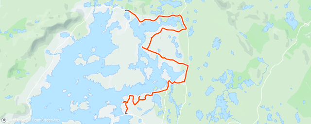
Stage 78: Co. Galway: Rosmuc Peninsula: Saturday 11 February 2023: 35.2km or 21.87miles
 |
| I covered every corner of Rosmuc Peninsula |
“I used to hope that my physical experience of Connemara would burn through all these layers of tracing paper into the final drawing, making it not just a factual record, but an expression of a feeling.” (Tim Robinson talking about his own map of Connemara)
Failte go Rosmuc! Ta me ar ais! Yes I’m back in the Connemara Gaeltacht now and I know I need to use my native language more. After having a winter break I continue my run today on 11 Feb 2023 which is exactly six years since I started this whole adventure with Helen and Sean.
I talked in the last few stages about myself and how I recently got my
bloods checked. I had discovered that my iron levels were very low. I needed to
take a dose of tablets for a few weeks and eat more foods with iron (like eggs,
kale and spinach). Now at last I am beginning to see the benefit. Crawfordsburn
parkrun in North Down is one of the toughest parkruns in the country, but I
struggled more than usual with my times during 2022, not been able to get under
25 minutes all year. Since November though I have gradually improved my time
and last week I recorded 22.08 minutes for the 5k.
 |
| Starting run at Pearse's Visitor Centre |
I begin today’s run at Pearse’s Visitor Centre, take a right turn on the
R340 and then after about 500 metres I take another right back down into the
townland of Rosmuc itself. After about 2km I take a left at Tamhna Bhig. I
follow this boreen all the way until I come to a crossroads where I take a left to the pier at ‘Snamh na
Bo’ (swimming place of cows). At low tide, cattle would be encouraged
to swim across the bay to the Camus peninsula, crossing through the small
island of Dunmanus. In the 1800’s there was a plan to build a road or bridge
across here and even today there are obvious signs of a wide causeway on
Dunmanus which was never completed.
 |
| Unfinished causeway on Dunmanus Island at Snamh Bo |
 |
| The Rosmuc junction with the three signs |
 |
| At Silear Harbour |
I take a left turn at the end of the Shore Road and head down to the SW
corner of the peninsula. On the way there I took a brief detour down to the
shore to Gairfean.
 |
| Gairfean Pier looking across to Eanach Mheain |
I reach the SW corner of the Rosmuc Peninsula. There ‘Oilean na
Mhada’ almost joins the mainland. It means literally, Island of the Dog
but Tim Robinson thinks it might refer to an madra uisce (the sea otter). Tim
walked along this coastline in 1980 and really did stick to the coast. (I refer
to him later in more detail) He was so thorough in finding exact meanings for
areas and refers here to a wee rock lagoon called ‘Lochan an Phriosuin’
(the pool of the prison), so called because a fisherman could get trapped by
the tide in their boat if they rowed in at high tide and left it too late to
leave the lagoon.
 |
| Heading to Rosmuc western Islands |
 |
| Only inhabitant going shopping on mainland |
Meanwhile I continue onto the island itself. There is a path that runs right
through Oilean Mor for about 1km. It starts as a rocky trail but progresses
into a beautiful grassy boreen and then ends up as a muddy path as I get closer
to an tOilean Iarthach (Western Isle). Even at low tide, crossing over to
this second island is treacherous. Steppingstones are covered in wet seaweed,
and I debated with myself whether I should attempt to go over. I’m glad I made
the extra effort as I was thinking I’ll probably never be back here again. It’s
hard to believe that there was once a school on this western island. It later
moved to Oilean Mor which was closer to the mainland.
 |
| Rough Trail on Oilean Mor |
 |
| But it turns into a lovely grass path |
 |
| Abandoned School on Oilean Mor |
 |
| Lovely path suddenly deteriorates |
 |
| Red seaweed an tOilean Iarthach (Western Isle) |
I leave the islands and after about 500 metres I take a rough trail on my left (which saves me going as far as the T junction) which leads me to Sean Bhaile (old town). In front of me, and down a hill, I see a quaint little pier with the twelve pins spread across in the near distance. I know immediately that this is the place described so eloquently by Tim Robinson ‘’a little harbour whence one might imagine souls setting forth into an eternity of ever-changing waters and mountains’’
 |
| 'Harbour of Souls' at Cill Bhreacain, Rosmuc Peninsula |
I leave the ‘harbour of souls’ and run north along the
main Rosmuc road, taking a left turn after the cemetery. I join the R340 about
2km west of Pearse’s Cottage and this allows me to loop around from the west
side, back to my starting point at the Visitor Centre.
On my car journey back to Galway, I’m able to recover and enjoy listening to the Ireland v France rugby international. It turns out to be an epic match. Just as I’m arriving in the city, the excited radio commentator loses his voice completely when Gary Ringrose goes over for a match-winning try for Ireland. So, a very satisfying day all round.
 |
| Leaving Rosmuc Peninsula |
The four horsemen (and one donkeyman!) of Rosmuc
I mentioned some of these people already in my Rosmuc adventure. All had ties to this area, and all played some part in the history and development of Ireland.
Padraic O’Conaire:
(1882-1928): I’ll start with the donkey man. Padraic was born in the southern
tip of the peninsula, in Gairfean (where his family had the shop). He described
journeys around Rosmuc on his donkey in his most famous book, Mo Asal Beag Dubh, (The Little
Black Donkey). Anyone who grew up in Galway City (like I did) would be very
familiar with O’Conaire’s sitting statue in Eyre Square which had been there
since 1935. His statue was very popular until
it was decapitated by four men in 1999. It was repaired (head put back on)
at a cost of £50,000 and moved to Galway City Museum in 2004. A bronze
replica of the statue was unveiled in Eyre Square in November 2017. O’Conaire
had been a close friend with Michael Collins but I’m not sure if O'Conaire ever met
Padraig Pearse. The two Padraics would have a lot to talk about as they shared
a lot of interests and both knew the Rosmuc area so well.
 |
| Dha Asal Beag Dubh (Two black donkeys) near Silear Pier |
Padraig Pearse: (1879-1916): The most famous person associated with Rosmuc. I
referred to him in more detail previously (see Stage 77). Pearse is famous for
reciting the Irish Proclamation outside the GPO in 1916 but also grew to love
the Rosmuc area. He bought a cottage here and returned, year after year until
his final summer in 1915. He wrote short stories and poems and gave that
famous speech at O’Donovan Rossa’s funeral in August 1915 which elevated him to
the leader of the 1916 rebellion. As I said last time, I can imagine him
wandering the boreens in Rosmuc, practicing and reciting those famous words. In
fact, we know that Pearse did walk all round the peninsula as one of his tales
was called ‘Na Boithre’. Bothar translates as roads, lanes or
boreens and in his story Pearse covers every townland on the Rosmuc peninsula.
 |
| Pearse's Cottage |
Alexander Nimmo: (1783-1832): I came across his name so many times on my coastal run as he built most of the piers and harbours in Ireland. He also took a shine to Connemara and especially the Rosmuc area and helped open it up to travellers and traders. By developing roads and bridges ‘he made its crooked ways straight’ Even up to the 19th century there were no proper roads in Connemara and they often took a longer route to avoid hills, rivers and streams.
 |
| Stage 79, heading towards ‘Cnocan na Leanbh’, near Beal an Daingin |
‘’I’m hooked on this game too. I go to absurd lengths to
complete the jigsaw puzzle. It seemed to me necessary to go everywhere and see
everything before I had the right to represent anything on my drawing. There is
scarcely anything on the map I haven’t set eyes on for myself.''
I love to quote Tim Robinson’s most famous phrase about him mapping the
coast
’While walking
the land, I am the pen on the paper; while drawing this map, my pen is myself,
walking the land’’. It reminds me of
what Van Gogh once said, ‘’I dream of painting, and I paint my dreams’’.
Tim Robinson describes his pleasure of being out in the wilds of Connemara....
‘’ I get such joy out of being out exploring this landscape
and being alone in it, out in the bogs or up on the hills, or on the shore. I
feel it’s a terrible shame that very few people are enjoying that. I never,
ever meet anybody.”
I also agree with these Tim's comments. I hardly meet anyone along the coast. I
know it’s only February but even on a Saturday in July it’s rare to see someone,
especially if you go a mile or two off the beaten track. Some of the places I
have passed are so isolated and untouched. I often feel that, so few people
have gone before me. The last people to walk through some areas of this land might
have been in pre-famine times, when Connemara was alive with thousands of men, women,
and children.
Stage 79:
 |
| With my brother Anthony at Pearse's Cottage |

 |
| With Dara who works at Pearse's Visitor Centre |
I pass Screeb House, a fishing lodge built in 1865 where Lord and Lady Dudley lived. Women also paid an important part in developing Connemara and Lady Dudley established a fund to help pay for district nurses in rural areas. The first Lady Dudley nurse in Connemara was Elizabeth Cusack, appointed to Beal an Daingin (my finish point today) The nurses travelled by bicycle along unpaved roads or walked across bogs and mountains to reach remote dwellings. They worked seven days a week and were always on call. Unfortunately, Lady Dudley herself drowned while swimming near Screeb House in 1920.
 |
| Screeb House |
Just after Screeb, I take the main road south along the R336. However I don’t have to stay on this road for long. After I pass a school and GAA pitch I take a right into Camas Uachtair. The translation of Camus is crooked and it is indeed a crooked and windy road around this peninsula.

Camus residents are
known by their nickname of Maicíní.
At the top of Camus Hill is the big O sculpture which looks quite spectacular
on a clear sunny morning like today. I notice a quotation on the big ring
 |
| The big O of Camus |
This quotation is by Desmond Ryan who was a friend and
great admirer of Padraig Pearse. Ryan himself was with Pearse in the GPO during
the 1916 Rising and recalls hearing a volunteer shout to Post Office officials
as they entered the GPO: ‘This ain't no half arsed revolution. This
is the business'. Although that phrase sounds more like something that Newman
or Redford might have said in Butch Cassidy and the Sundance Kid.
 |
| Snamh Bo from the Camus side |
I return to the main road (R336) but again, I
don’t have to stay on it for long. After passing the school, and at a sign that says ‘Madra’, I take a right. This area is called Cinn Mhara. I know there is a better known Kinvara on the
south shore of Galway Bay, but I’m wondering if this Connemara Cinn Mhara is the one referred to in the very first sentence of O’Conaire’s ‘Mo Asal Beag Dubh’.
It's another crooked road along here that leads me
to a small but modern bridge. This area is called Muiceanach idir Dhá Sháile, meaning 'pig-marsh between two
sea inlets'. It was previously anglicised as one long word, Muckanaghederdauhaulia
and once known as the longest named place in Ireland. However, it has now
(thankfully) reverted back to its proper Irish name.

This example shows how stupid this whole translation business had been. The writer Brian Friel wrote a famous play called ‘Translations’ set in the 1800’s which covers this subject. A character in the play, an English visitor is working on an Ordnance Survey map and is translating Irish place names into phonetic English words. This is also a subject close to Tim Robinson’s heart and he describes it well when he says ‘’Irish place names dry out when anglicised, like twigs snapped off from a tree’’.
 |
| Another unfinished road in Connemara |
I kept going, knowing that I was going to have to meet a final sea-channel. The terrain was becoming rougher too and there was lots of heather, small trees and thorny brambles. At first it looked as if the sea-crossing would be too wide (and deep) so I was resigned to going back all the way and taking the bog road south. However, through the brambles I spotted a narrower channel and made my way down through slippery rocks. I dipped my shoes in the water and waded my way across. It was a short crossing which only came up to, just below my knees.
 |
| Crossing narrow channel towards Beal an Daingin |
 |
| Enjoying chocolate on stone wall |

On the other side of
the water, I only needed to climb up a grassy bank. I was very pleased with
myself for finally reaching the west side of the channel. Afterwards I sat on a
stone wall and rewarded myself with some chocolate. I had a real sense of
achievement as I had looked at this crossing so many times on ordnance survey
and google maps. I was lucky that, in any case, the tide was going out and it
was a perfect sunny day.
Once on this side of the sea inlet I could also see the ‘pre-famine road’ that seemed to be heading down towards the sea. It was obviously going to join up with a proposed bridge across the narrow sea (towards Camus). The bridge and road were never completed! I can only conclude that this project, like many others, was started during the famine years and never finished because people were dying or leaving the area.
 |
| Pier with no name, NE of Beal an Daingin |
I continued as close to the coast as possible. Just north of Beal an Daingin I took a turn down towards the coast. There I saw a new cemetery at the bottom of the hill and opposite it was, what looked like an older graveyard, on a small hill by the sea. I suspected that this was another Cillin (a resting-place for unbaptised children that weren’t allowed to be buried in a proper cemetery). Sure enough, I learned later that this site was called ‘Cnocan na Leanbh’ (the hillock of the infants)
 |
| Cnocan na Leanbh where unpaptised babies were buried |
Stage 80: Co. Galway: Beal an Daingin loop, circling islands of Eanach Mheain & Leitir Moir: Thursday 16 February 2023: 28.79km or 17.89miles

I drove out from Galway City this morning, parking my car again in front of the Costcutter in Beal an Daingin. Even though it was quite dry when I began my run, I decided that it would be wise to wear my green-waterproof jacket. A good decision as the rain came later.
 |
| Mural at Beal an Daingin |
I am heading into island country or ‘Ceantar Na Oilean’ as this area is called. I cross the first causeway (Bealandangan Bridge) which brings me onto Eanach Mheain (I circled this island later today). There is a tricky part of the road and a sharp bend as I pass the Hooker Bar (or Tigh Mhichael Jack). I then cross a second causeway, Oilean na d’Trachta which brings me onto Leitir Moir island itself.

I continue running for another 2km, through the island, as far as the church where I take a right turn along the southern shore. Along here I spotted a small memorial in front of a house with the initials FDNY. The inscription says, ‘Teach an Fir Doiteain Sean’. (House of the firemen, Sean) and had the 9/11 date on it too. I was reading about the 2001 disaster, and it is estimated that about 1,000 of those who died had Irish connections. Sadly, over 200 Claddagh Rings were reclaimed from Ground Zero.

This western part of Leitir Moir is called
Leitir Calaidh and shortly, I take a left, signposted, ‘An Ros and Inis
Bearachain’. Bearachain is an island about 500 metres off the coast and this is the best route to take to get there. Further west on Gorumna Island, Bearachain used to be accessible by foot but only at a very low tide, and by using steppingstones. That path is called ‘Bothar na nOilean’ and I
will come close to it on the next stage of my run.

 |
| A quartet of donkeys |
 |
| 'Ceibh an Rosa' harbour |
 |
| Causeway to Inis an Ghainimh |
The country road comes to an end, but as my
plan is to circle Leitir Moir, I now must rough it across the bog. A pathetic
sign, that has seen better days, shows an arrow pointing upwards and a faded picture
of a walker. Welcome once again to the Irish coastal path, which by the way,
doesn’t exist! At least there are rocks to clamber over, which is slightly
better than boggy fields. However, suddenly the rain comes down, so I need to
be extra careful on the slippery stones. I see what looks like a house close to
the shore, so I head for that as I figured there would be a road leading to the house.
 |
| Pathetic walkers sign (I'm on my own now!) |
As I’m running through some fields to the house I spot a lone cow (or bull). Ever since my experience in Donegal (when I was chased by a herd of cattle), cows have become my least favourite animal. Furthermore, I have just been reading about an episode that happened not far from here, about 4km from Maam Cross. The area I'm referring to is called ‘Doirin na gCos Fuar’ (small wood of the cold feet) for reasons that the historian, Tim Robinson explains. A farmer was killed by a bull in a wood and then eaten by the animal. All they found of the man was his boots with the feet still in them! So, I don’t want to be a similar statistic, ‘he died with his boots (or hokas) on’
In any case, when I reach the shore, I realise the house is really more of a shed and there doesn’t seem to be any kind of a track leading to it. It’s getting miserable now as I run inland, through the wet fields. Eventually I do find a trail that leads to a road on the NE corner of Leitir Moir.
 |
| An Sruthan Bui |
So, I head north again, crossing na d’Trachte causeway but this time taking a left onto Eanach Mheain island. I’m feeling pretty miserable now with the rain coming down and hungry too. I finish the last few squares of chocolate I have.
 |
| A wet soul at Eanach Mheain Pier |
 |
| Crossing over to Laidhean Island |
 |
| Golf Course but no golfers today! |
It actually turned out to be quite a pleasant experience running around Eanach Mheain. I take a left down to the pier on the west of the island but on my return journey I’m able to follow a trail that brings me onto a Golf Course on the north side. It's 'Connemara Isles Golf Course'. No surprise that there are no golfers here today. Part of the golf course is on another wee island Laidhean which is joined to Eanach Mheain by a short causeway. I’m able to circle this tiny island completely.
 |
| Club House of 'Connemara Isles' |
 |
| Guinness barrels have arrived! Ready for new golf season |