Monday 31 October 2022

STAGES 76-77 Co. Galway: Glynsk to Rosmuc


 31.77km or  19.74miles

 “After Mass, the rain had drained away into a tide of sunlight on which we sailed out to St MacDara’s Island and dipped our sails. Both of us smiling.” (Paul Durcan) 


We returned to Glynsk House where I finished my run the last time. I asked the manager there at the restaurant, ‘are we in North or South Connemara’. She replied, ‘ye’re in the centre of Connemara’. I’m confident that after this weekend that I will have reached deepest South Connemara which is which is full of wee sea inlets, long peninsulas, and scattered islands. The big issue today and tomorrow was trying to avoid the heavy rain blowing in from the Atlantic Ocean. It poured all morning and it’s still raining at noon as we leave Galway City. Not much visibility as we reach Maam Cross and we can only see one or two of the twelve pins. However all changes when we reach Glynsk.and it turns out to be a beautiful day. Maureen and Brian stop there for lunch, and I start my run.

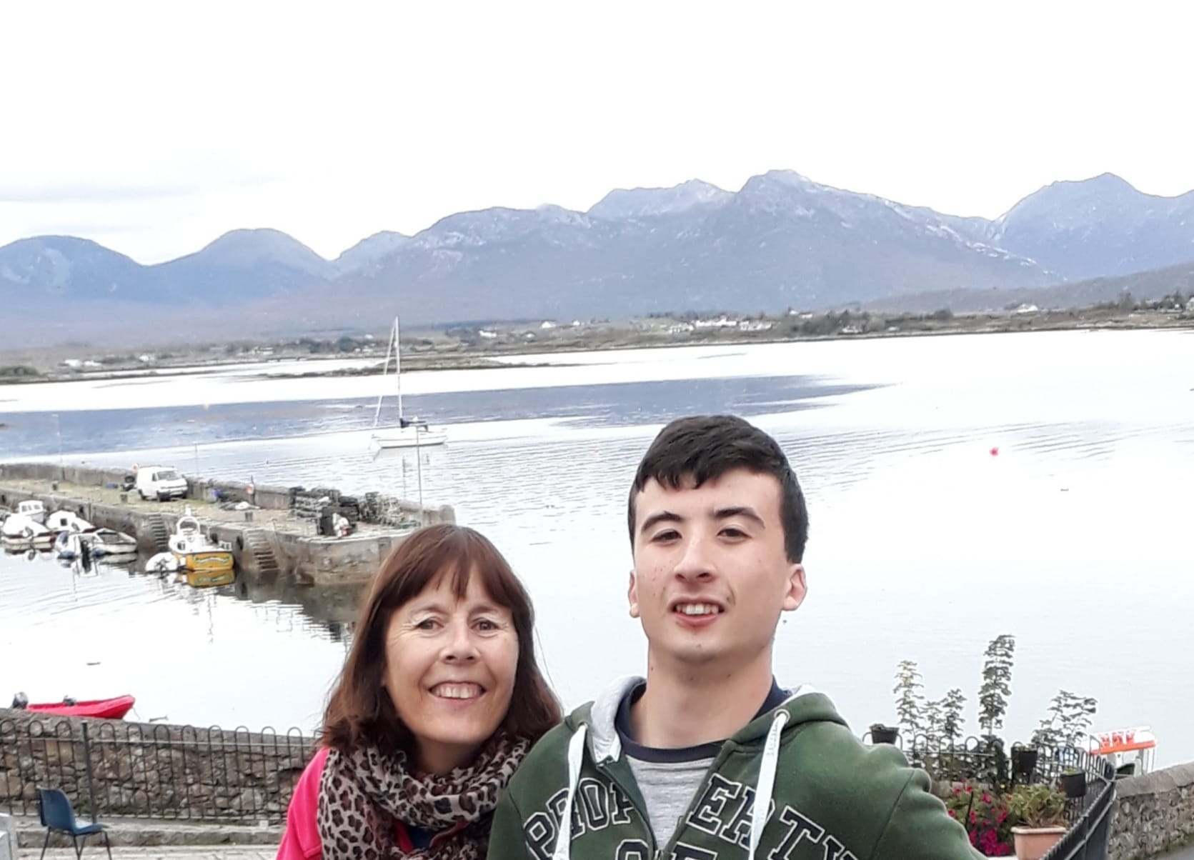
Halloween at Glynsk House

There is a rich history of music and songs in this part of Connemara and the famous musician Seamus Ennis collected tunes in this area and helped revive traditional music in the 1960’s. His own speciality was the beautiful sounding, uilleann pipes and he even inspired groups like Planxty. It all started in 1942 when he was employed by the Folklore Commission to visit Connemara to collect ancient tunes. He was given ‘’a pen, some paper and pushbike’’.

Unfortunately, I don’t even have a pushbike today and I could have used one as I headed west from Glynsk along the quiet country roads. After getting some blood tests recently I’ve found out that I’m anaemic, so lately I’ve been eating a lot more foods with iron. I think it’s helping.   


At least the rain has stopped. I spotted a lovely mural on a house overlooking the island Freaghillaun. I’ve come across a few other islands called Freaghillaun (Heather Island) in Galway and Mayo in my travels. Here I got talking to Ray and his wife Jill and I told them about my adventure. Co-incidentally I also bumped into them later that night in Tigh Chadhain’s pub in Cill Chiarain.  


Following the road all the way down to Moyrus (Mairois) beach, I pass a cemetery (or Reilig in Irish).  It’s turning out to be a beautiful sunny day now with all the clouds disappearing.

Moyrus Cemetry (Reilig Mhairois)


Moyrus Beach with Iorras Beag behind

I pass a memorial dedicated to four men who were drowned in February 1921. This was the time of the ‘War of Independence’ and they were young volunteers making their way by boat to Roundstone. They perished after a violent storm around the island of Inishlacken.

Memorial to four young men drown at sea

Running along the beach I’m able to stay by the shore and follow a coastal track called ‘Luibin Mhairois’ (The Moyrus Trail). There are even stiles and markers along here which you don’t see often on the Irish coast. However, after all the rain we’ve had over the last few weeks, it is very damp and muddy on this path. There are a few large boulders and it’s hard to decide whether to clamber over the big rocks or to try to stay on the flooded grassy trail. 

Always great when I see a stile

And always reassuring when I see a 'You are here' map!

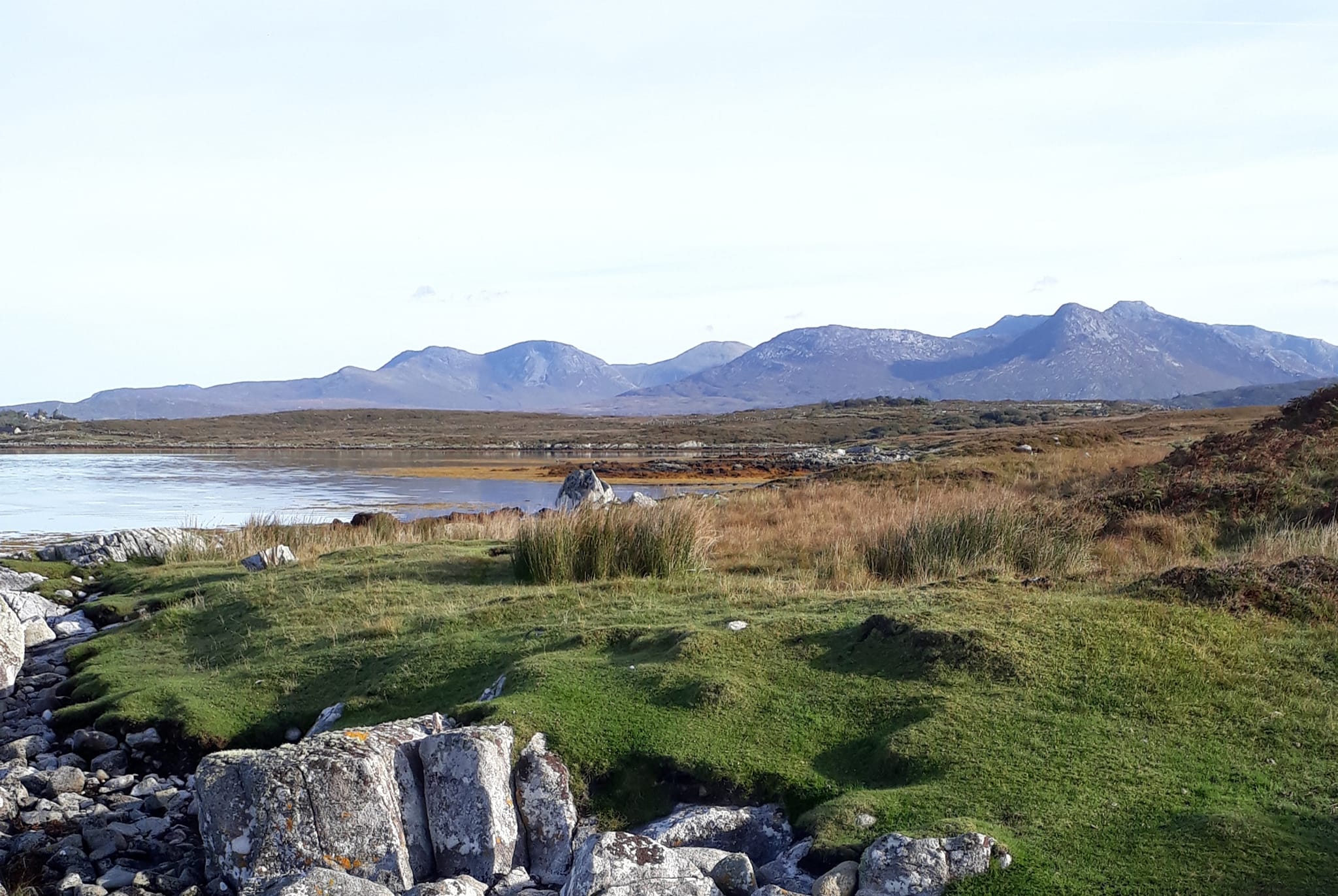
I’m really appreciating the lovely weather now and the beautiful views back towards the Maam Turks and the Beanna Beola (twelve pins). It’s a perfect afternoon in the middle of a long weekend but I still don’t meet anyone else along here.

In the distance I spot the Global Aerosol Watch station which is one of the longest running mercury recording stations in the world. The station’s position in the countryside is important, away from neighbouring towns to ensure that no pollutants interfere with recordings. I can vouch for the fact that this is indeed a very remote location.

I reach Dooyeher and I’m able to join a country road for a while as far as An Leathmhas (Halfmace) but then the boreen comes to a sudden end. I decide (in my wisdom) to rough it across a few wet fields and over some dreaded barbed wired fences as I know I can reach another lane. A Connemara pony is watching my every move and I’m trying to stay out of his territory. Along here I spot a row of deserted houses, a reminder of how previous families tried to make a living here, on the edge of the Atlantic.

These markers are guiding me along the Moyrus trail 

This whole area has a strong history of emigration and it’s interesting to point out that Marty Walsh, recent mayor of Boston has a strong connection to south Connemara. His father was from Carna and his mother was from Rosmuc. Mayor Walsh was the perfect person to open the Emigrant Commemorative Centre in Carna. Bonfires welcomed him and signs said ‘Fáilte Abhaile, Mayor Marty Walsh’

I eventually make my way across the damp fields to a harbour, Ceibh an Mhasa which is probably the nearest point to the popular St, Macdara’s island. I follow the road north and then when I reach the junction I take a right and continue back down to the other side of the harbour. Here I have a better view of Mason Island and MacDara’s island. Saint MacDara is the patron saint of fishermen and people have lived of the land and sea in this area for 1,500 years. There’s even a special saint’s day (and festival) devoted to MacDara on 16 July. Locals say St MacDara’s Day can feel like Christmas Day with so many people returning to the area. 

View of St. McDara's Island from 'Duirling na Spanneach'
I see on my OS map that there’s a road just south of Loch na gCaor and if I take this boreen I can reach another country road. However, my way is blocked by a farm gate which I climb over. I have to manoeuvre my way across a narrow river and a few more wet fields before I reach another lane. Along here I meet a man who tells me that its exactly four miles to Carna. He also scratches his head and asks how I got here!

On this crazy adventure around the Irish coast, I've referred so often to the many Spanish Armada ships that sunk in 1588. Remember, the Spanish were losing the 'Battle of Gravelands' against the British Navy and decided to take the scenic route north from the English Channel. So they sailed up the east coast of East Anglia and Northumbria, circling Scotland completely and then headed south along the west coast of Ireland. Two more of their ships went down off the Connemara coast. The 'Falco Blanco Mediano' crashed just a few miles north of here, near Freaghillaun island and the 'Cocepcion Delcano ' (or 'La Concepcion') sank here at the spot where I am now. This area is called Ards or more specifically 'Duirling na Spanneach' (rockbank of the Spaniards). Over three hundred Spanish sailors survived and Sir William Fitzwilliam, the Lord deputy of Ireland, gave orders that they be brought to Galway City to be executed. They were then taken to St Augustine's Monastery, now Forthill Cemetry. Over three young hundred Spanish sailors were then beheaded and presumably buried without any ceremony in Forthill. There is a plaque in Forthill Cemetry, near Galway City docks with inscriptions in Irish and Spanish, remembering this terrible event.

As I'm leaving 'Duirling na Spanneach' it's starting to drizzle. When I finally reach the village of Carna I stop to get water. It’s the first shop I’ve passed all day and so glad to quench my thirst. I’m in the heart of the Gaeltacht now and I tell myself to make more of an effort to speak Irish. The rest of today’s journey is straight forward as I continue east for eight kilometres on the main R340. The house we’re staying at is called Aill na Brun, just about a mile west of Cill Chiarain. Maureen and Brian are already settling in when I arrive after completing today’s adventure.


Stage 76 (Revisited): Co. Galway: Islands of Mweenish & Roisin na Chalaidh, Carna: Monday 31 October 2022:  13.44km or 8.35miles

 'How lucky the young man who will have her to wed, the guiding star of the morning, and a torch in the evening' Padraic Ó Flatharta from Carna

It is a miserable morning here in south Connemara. No sign of the rain stopping, and the trick is, to avoid the heavy showers. At least I’m not too ambitious with my run today. I sneak out of the house in Cill Chiarain at about 7.30 am and drive the five miles to Carna, parking my car at the big car park at Tigh Mheaic. Just as I’m ready to begin my run to the islands, the heavens open and torrential rain falls. I quickly retreat to my car and wait for it to subside. Eventually I start, following the road south towards the island of Mweenish (Maoinis).

First I have to cross a causeway to the island of Roisin na Chalaidh. It’s hard to believe that 53 people lived on this tiny island in 1841. I don’t think the causeways were built until the 1890’s so it would have been difficult for people then. Today as I approach the island it’s hard to spot any dry lands. With all the rain and floods, there is water everywhere, especially on Roisin na Chalaidh Island. It’s difficult to imagine anyone trying to make a living in this small space.

View from Mweenish Island back towards Carna
 
View from Mweenish with causeway to mainland

I keep running south and finally reach Mweenish Island. Six hundred and fifty people lived here in 1841. The islanders are famous for building 'Galway Hookers' which were used to carry turf across Connemara and even as far as the Burren in Co. Clare. 

When I arrive in Mweenish I spot a small beach on my left-hand side but first I decide to follow the road west. More torrential rain starts falling. I spot a man on the road, and he welcomes me to stand in his shed until it stops. I run to the most westerly point on the island spotting Mason Island a few hundred metres across the sea. The island has been uninhabited since 1954. The writer, Liam O’Flaherty describes the last residents to leave Mason Island who probably embarked at this spot.

 “When a frail canvas currach rode in from the Atlantic and touched ashore on the sandy beach at Mweenish, Connemara, two figures, sixty years old Patrick Cloherty and his fifty-nine years old sister, Mary, arrived in a new and strange world.”  

The ‘strange world’ they arrived on was here on Mweenish island but connected by bridge to the mainland. Patrick and Mary would at least not be depending on the roughness of the sea to make a journey from Mason Island. Both were deaf since birth and had never previously left home. I also read how previous storms had washed over Mason Island carrying away the provisions of twenty-six families. The account stated that beds and dressers were found miles away, smashed on the mainland shores.

I return to the centre of Mweenish and head to the southern corner where there is a lovely beach. I can see Finnish Island across the water. Even from a distance I spot a few of its sandy beaches. Finnish is a tidal island that can be accessed from the R340. It’s halfway between Carna and Cill Chiarain. I hope to tackle it is next year, maybe when its dryer.

 South corner of Mweenish with Finnish island behind

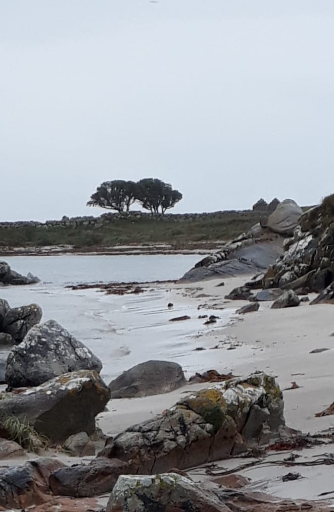
Mweenish - I wonder how these trees survived the strong Atlantic winds

It's a pity that I don't have the low tide today as I could have followed the shoreline on my return run to the mainland. Instead, I double back on the country road. The cows are mooing like crazy now as I run pass. In fact, all this weekend I’m hearing the loud sounds from cows, horses, donkeys and birds. Obviously farm animals not used to too many strangers around here. I finally make my way back over the two causeways to Carna, following a loop road that brings me to the village where I had parked my car.


               Stage 77 

Co. Galway: Cill Chiarain to Rosmuc

    Sunday 30 October 2022

         14.59km or 9.07miles

 Sometimes my heart hath shaken with great joy to see a leaping squirrel in a tree, or some green hill where shadows drifted by (from The Wayfarer by Padraig Pearse)

I wake about 7.00am in the house we’re staying in at Cill Chiarain. I have a vague plan today about how far I’ll run but first I’m waiting for the heavy rain to stop. I take my time, having a light breakfast and eventually at about 8.00am the weather seems to be improving and I step outside. Today I’m running along the main R340 but even after a few miles my legs are feeling the effects of yesterday’s adventure. This section is hillier than I expected, especially with the granite hills of Cnoc Mordain (Knockmorden) on my left side as I run (and sometimes walk) along the road. 

Cnoc Mordain, just north of Cill Chiarain

I decide not to gamble any more with my good fortunate of avoiding the rain this weekend and so, I make a decision to finish today’s stage at Padraig Pearse’s Cottage in Rosmuc. Also, I’m conscious that this would be an easy place for Maureen and Brian to meet me later and a well-known location to begin the next stage of the Coastal Run (probably on 11 February 2023).

I’ve been to Pearse’s Cottage a few times before. I was here with my older children twice in the last twenty years and I first visited the cottage over fifty years ago with my own parents. I’m also old enough to remember the fiftieth anniversary of the 1916 Rising and I can recall learning the Irish Proclamation off-by-heart in St Patricks Primary School in Galway City. Of course, it was Padraig Pearse who most likely composed the Proclamation. Pearse famously recited it out outside the GPO in Dublin on Easter Monday 1916 to an ‘amused and bemused audience’.

Padraig Pearse's Cottage, Rosmuc.
The Cottage itself is situated on an elevated site by Loch Oiriulach and was a summer retreat for Pearse between 1903 and 1915. He was inspired to write at the cottage, and it is accepted that he composed another famous and powerful speech here in July 1915. This was the graveside oration that Pearse gave for O’Donovan Rossa in Dublin on 1 August 1915,

Today, just beside the Cottage, there is large Cultural Centre just off the A340 at Rosmuc (Ionad Culturtha an Phiarsaigh). While waiting on Maureen and Brian to arrive I was able to enjoy the exhibition. Personally, I would not have been a great admirer of Pearse and the men of Dublin 1916. To me the real heroes of Irish Nationalism were Parnell and Davitt who campaigned for land rights especially in the west of Ireland. In fact, on the very day of the Easter Rising on Monday 24th April 1916, my own grandfather was among a group of farmers in East Galway who were protesting about land ownership. 
So, while Pearse was reading out the Proclamation outside the GPO, my grandfather was among a team of men ‘driving cattle’ to a landlord’s home. Driving Cattle was a protest method used to highlight land ownership. My grandfather, Martin Boyle and nineteen of his neighbours were tried in court for this disturbance. After the trial, my grandfather and three of his neighbours spent nine weeks in jail. On the other hand, Padraig Pearse only had nine days in prison. He was executed (without any trial) on the 3rd May 1916. Even I was shocked (after researching) that the executions of the 1916 leaders took place so quickly after Easter Monday (24th April)

Pearse getting ready to speak at O'Donovan Rossa's funeral: 1st August 1915

While I was at the Visitor Centre in Connemara (just beside Pearse's Cottage) I was also able to hear Padraig Pearse’s famous speech that he gave at O’Donovan Rossa’s funeral in August 1915. It is impressive and although an actor is reciting Pearse’s words, it is very powerful to listen to. Sean T O’Kelly, a future Irish President, who was present at the funeral, stated that Pearse gave the speech without any notes. We can imagine Pearse at his cottage and around the Rosmuc countryside practicing these words. He felt privileged that he was picked to give the graveside oration for O'Donovan Rossa who was 83 years old when he died.        

 ‘that I, rather than one of the grey-haired men who were young with him and shared in his labour and in his suffering – should speak here'

In his speech Pearse then goes on to criticise the British Establishment or the Defenders of the Realm as he calls them. His words are full of emotion and he keeps building up momentum to the conclusion.

 ''The Defenders of this Realm have worked well in secret and in the open. They think that they have pacified Ireland. They think that they have purchased half of us and intimidated the other half. They think that they have foreseen everything, think that they have provided against everything; but the fools, the fools, the fools – they have left us our Fenian dead; and while Ireland holds these graves, Ireland unfree shall never be at peace.''

 It's well known that the men who occupied the GPO and other government buildings during Easter 1916 might have been easily forgotten about. Most Dubliners at the time were not impressed by the Irish rebels and when they were arrested they got little sympathy from the locals. However, after the swift executions of the men (and without any trial), public opinion began to change. Ironically Pearse’s words at O’Donovan Rossa’s funeral came back to haunt the British establishment ‘’the fools, they have left us our fenian dead’’. As time passed the dead leaders of 1916 became heroes and martyrs.

Friday 30 September 2022

STAGES 74-75: Ballyconneely to Glynsk

At Roundstone (Nimmo's) Pier

                      Stage 74

Co. Galway: Ballyconneely to Roundstone                                            Thursday 29 September 2022

              22.73km or 14.12miles

 "Sometimes the most scenic roads in life are the detours you didn’t mean to take." (Sign outside Coffee Cottage in Roundstone)


With Covid not so prevalent now, and people travelling more, it is getting difficult to find a place to stay. Luckily for me I have that Galway connection and I can use the city location as a base for these Connemara runs. We did find a lovely B&B (Island View) in Roundstone on the Thursday night with the perfect host in Maurice. Also, two weeks ago, I ‘pre-visited’ this area and completed Inis Nee Island and Rosroe Peninsula (in perfect weather) which made it easier for me over these days. 
It’s a beautiful afternoon in Connemara. We drove out from Galway City this morning, Maureen, and Brian dropping me off in Ballyconneely. 
For the first few miles I ran along the main R341, taking a right at Murvey. I probably could have taken an earlier turn at Callow that would have brought me down to the shore, but I wasn’t sure of the terrane there. In any case on the Murvey road I was able to run on a lovely boreen that followed the coast for a while. 

At the end of the boreen at Murvey, near Roundstone

Croaghnakeela or Deer Island

Just as the wee road came to an end I met a father and son who were building a wall, making the most of the fine weather. The man pointed out for me the island of Croaghnakeela although he called it Deer Island as it was once stocked with deer. I left the working men, and I was able to rough it for about half a mile over a rocky hill before reaching another trail. As I climbed over a small summit I could see this beautiful beach in front of me. It was Dogs Bay beach (Tra Chuan na Mhada) in all its glory. As I was already close to the coast I contemplated staying by the shore and trampling across a few fields to get to the strand. However, I thought it wiser to follow the proper trail back up to the main road. It was a good decision because when I reached the main road I had the perfect downhill run and my fastest kilometre (4.51) of the two days.

Dogs Bay or Tra Mhantan

In Irish, Dogs Bay is called Tra Mhantan, and I think Mantan was an apostle of Saint Patrick. When I reached the beautiful beach I kept running, even meeting along the way a French ultra-runner, Michel Le Merle and his wife Janet. I continue around the whole peninsula as far as Gorteen Point and join Gorteen Beach on the other side. These two beaches form, what’s called a tombola, which juts out into the Atlantic.

With Michel Le Merle (Ultra Runner)
Inishlacken Island: Out in the bay I can see Inishlacken. I’m not the first person from the north east of the country to visit this area. In 1951, Belfast artist James MacIntyre spent a summer on the island of Inishlacken, with fellow Belfast artists Gerard Dillon and George Campbell. Years later, he wrote about their exploits in his book Three Men on an Island.

Gorteen Bay

Gorteen Bay: Maureen & Brian are dots in the distance
This looped run was tougher than I expected with lots of boulders on the southern part of the peninsula to manoeuvre around. However, the rewards at the other end when I eventually reached Gorteen Bay (Port na Feadoige) were more than worth it. Such a spectacular crescent shaped beach with the perfect white sand and clear blue water. To cap it all, Maureen and Brian were there to meet me. We walk together for a while along the beach and even when they leave me I try to say as close to the coast as possible. 

Brian & Maureen on Gorteen Beach with Inishlacken Island behind
 
I thought I could make it along the shore all the way to Roundstone, but the surface got much too difficult. I think if I had persevered a little more past Ervallagh I could have made it the whole way and joined up with a coastal trail. Instead, I ran up the boreen to the main road that took me to my destination for today
Roundstone with Twelve Pins behind

Cloch Na Ron, Bruce Ismay and Alexander Nimmo

The name Roundstone is a bad English translation and I much prefer the prettier sounding Irish name, Cloch Na Ron” (Rock of the Seals). It’s said that Bruce Ismay, chairman of the White Star Line (owners of Titanic) came here in 1912 for some peace. I figure he wasn’t very popular after surviving the voyage by getting onto one of the lifeboats. Another famous character, Alexander Nimmo had no formal education in engineering but designed so many piers and harbours around the country. In Galway City there is even a pier in the Claddagh called ‘Nimmo’s Pier’. He was Scottish and only came to Ireland when he was in his twenties. He had a special devotion to Roundstone and not only, constructed an impressive new harbour but also went on to develop most of the village itself. It is believed that Alexander Nimmo is buried in the village but it’s not clear where exactly his grave is.


        Stage 75           

        Co. Galway: Roundstone to Glynsk

                 Friday 30 September 2022

                 28.12km or 17.47miles

  "I can only think in the dark and in Connemara I have found the last pool of darkness in Europe." (From Tim Robinson’s book, The Last Pool of Darkness)


Inspiration sign in Roundstone

I almost cancelled todays run! Hurricane Ian in Florida has destroyed a lot of property in the US and according to the RTE Weather Forecast the storm is coming to the west of Ireland, with torrential rain and strong winds. And yes it did rain a lot during the night and it was quite blustery in the morning. Maurice at Island View B&B told me to be especially careful on the narrow road out of Roundstone. I thought it was wise to wear my green, slightly waterproof jacket. It did keep me warm and dry but I was conscious that I might not be seen clearly by oncoming traffic.

Even the sea looks rough today

It’s 8.03am, dark and wet as I start today’s run. After about 3km I passed the bridge to the island of Inishnee. In hindsight it was such a good decision to complete this island two weeks ago when the weather was much better (see later). Despite the miserable rain today I was also lucky to have a strong west wind behind me. 

Another one of those signs in Roundstone - I needed that inspiration today.

I followed the main road and after another 2km I took a right turn and another right, heading south towards the old village of Aillenacally. The village contains fourteen houses now deserted and in disrepair. Nobody has lived here since the 1950’s. An Irish American has bought some land here and maintains that Aillenacally is the ‘oldest village in Ireland’. Years ago, schoolchildren used to walk from the village in a north direction through the bog to the school at Toombeola. I had read that there were steppingstones to guide you across the path. It was called ‘The Scholars Road’. According to local writer Michael Halliday, the walk or trail starts about 400 metres up from the shore but it's still difficult to find. Luckily for me, I met a local farmer at the exact spot where the steppingstones began. He didn’t seem to know it was called ‘The Scholars Road’ but he knew about the stones and literally pointed me in the right direction. At this stage it was pouring rain, but I was able to make my way across the bog, trying to find the odd stone to step on. Sometimes it was so boggy and wet that I had to leave the 'path' for a dryer section. I worried that I might lose the path as it wasn't that obvious to see. All the time I was thinking of those poor children on cold and wet mornings taking this same journey. It stopped me feeling sorry for myself. 

About two thirds of the way across I did lose the trail. The stones seemed to disappear, so I had to plod along through the fields. Eventually I could see houses nearby and I was able to climb over a farmgate to reach the main road at Toombeola. The literal translation is 'Tomb of Beola'  and Beola was an ancient chief in Connemara).

This is along Lehenagh peninsula

Shortly I cross over a bridge and then take a right turn signposted to Cashel. This section of the road is quite narrow and winds its way around the shore. I’m reminded of how Tim Robinson described it ‘the road has to swerve and twist like a cyclist chased by a snappy sheepdog’. Robinson was an English writer who sadly died recently in 2020 due to the coronavirus. He was a Yorkshire writer who like the Normans ‘became more Irish than the Irish themselves’. He had lived here since 1972 and became a well-known historian in Connemara. I think I would have got on well with him. He began to explore and record his surroundings closely, walking on foot and even, designing his own maps. I wish Tim Robinson was around to guide me along this part of the shore. I love the way he describes his own coastal adventure

 ‘’While walking the land, I am the pen on the paper; while drawing this map, my pen is myself walking the land’’

I passed by the entrance to Rosroe Peninsula and again count myself lucky that I’ve already completed that section of the coast (see later) in much better weather.

Cashel House Hotel

I decided to have a break here at the hotel and hopefully get some water to drink. All that rain and I'm still thirsty! The sign outside the hotel said ‘Residents Only’ but I ventured inside where I noticed breakfast was being served. A young lady gave me a big jug of water and I sat in the lobby knocking back a few glasses. 

Back in 1969 Charles de Gaulle, just a month after his resignation as president of France, came to Ireland, and spent two weeks here at the hotel. Cashel House only received a week’s notice that the big man was coming. There was great panic as management worried they did not have a bed big enough for the 6 foot 5 inches (1.96 metres) Frenchman. I like the comment in the Irish Times at the time that has a connection to my adopted town in Northern Ireland. ‘The presence of General de Gaulle here is almost as bizarre, in its first impact, as would be the announcement that Chairman Mao had arrived in Bangor, Co Down, to enjoy the amenities of Pickie Pool.'

At the time De Gaulle tried to explain why he came here. 'It was a sort of instinct that led me towards Ireland, perhaps because of the Irish blood that courses in my veins.'  There was some truth in De Gaulle’s comment about his Irish blood. His grandmother was descended from the McCartans of Co Down and she even wrote a book about Daniel O’Connell.  


The rain was still coming down as I left the hotel. My waterproof jacket didn’t completely keep out the rain and I could feel the cold even as I started running again. Shortly I took a right turn at Cashel Education Centre. I followed this road on the peninsula to Lehenagh down to the sea. Not many creatures around today, although at one stage I did see a hare as big as a dog, scampering across the road. When I reached the coast I doubled back to the main road and then followed the R340 that eventually led me all the way to my finish line in Glynsk. 

I'm glad to have completed today's adventure as I have been feeling more tired recently. I think the two marathons I did in the springtime took a lot out of me. Recently I got my bloods checked and I was diagnosed as being anaemic with low iron levels. A second blood test proved more positive, but I am realising I’ve got to eat more iron-based foods. That can be hard sometimes as I do not eat any red meat. Maybe two days of running caught up with me. The good news though was that Maureen and Brian were there to meet me and we enjoyed delicious tea and scones at Glynsk House, watching the sun making its first appearance of the day and brightening up those dark hills of Connemara. 


Stage 75- PRE-visit: Saturday 17 September 2022 Rosroe Peninsula, Cashel. 16.01 km or 9.95 miles

Yes this was a pre-visit rather than a revisit and I completed it two weeks before the main stage in much better weather. It was a tough section, and I knew it was going to be difficult. As I drove out from Galway City I watched the early morning fog clear to reveal the peaks and valleys of the twelve pins (na Beanna Beola). 
Rosroe Peninsula with na Beanna Beola behind

The early sunshine over the mountains lit up the whole of Connemara. I parked my car in a lay-by just opposite, what was once, Willie Bolgers Pub and headed back along the road. As usual I was running anti-clockwise, with the sea on my right. Rosroe probably translates as the ‘the red peninsula’ called after the boggy terrain. I couldn’t find anything on-line at all about this area so maybe I am one of the few people to circumnavigate the Rosroe peninsula! Although I know for a fact that the famous local historian, Tim Robinson did walk every section of this coastline. It was the perfect morning for a run along, what started as a country lane, even if the trail became rougher and rockier. The trail eventually disappeared after only about 2k. I had to slow down as I trampled through the bog and the long grass. I thought it was best to get closer to the coast and it did seem a bit easier even if there was no proper beach to run along. 

Looking across Cloonile Bay to Inis Nee Island

No sign of anyone along here. It's so quiet and peaceful with perfect calm water as I run along the southern shore of Cloonisle Bay (or Blackhaven Bay). In the distance I spot a lone fishing boat across the sea heading towards the pier at Inis Nee Island. 

SW corner looking toward Oghly Island
I fine a trail again!

Climbing over a few barbed-wire fences, I eventually reached the SW corner of the peninsula. I must have scared the local wildlife as a seagull or tern came screeching along the shore and was still quite vocal as it flew away. Across the bay I could see Oghly Island. (Oilean an Chlai). Later when I was running around Inis Nee, I spotted the island from another angle. It looks quite pretty, has a nice beach and apparently a tidal swimming pool. Definitely not an ugly island! 

Canower Harbour

Stand off with cow near Canower Pier
Meanwhile here, on the south side of Rosroe peninsula I eventually found a rough and rocky trail that joined up with the country road near Rosroe Lodge. On the way back I took a slight detour down to Canower Pier and ran to the end of the lane. A cow blocked my way here, standing in the middle of the lane and making me run on the grass to get around.  It seems that cows have become my number one enemy on this grand adventure of mine. Finally, I reached my car on the main road where I had a banana and a good drink of water before driving towards Roundstone to tackle Inis Nee Island.   

Stage 75- PRE-visit: 11.38am on Saturday 17 September 2022 Inis Nee Island 12.03km or 7.48miles


Yes another pre-visit two weeks before doing the main section of Stage 75. After completing Rosroe Peninsula (see above) I got into my car and headed west, taking a left turn, signposted Inis Ni, just before Roundstone. I drove across the bridge and parked my car on the grass verge. Even before the bridge was built, islanders could make their way across the rocks, to reach the mainland. That was probably the case in 1901 when the island population was 323 – it went down to 24 in 2002 and now thankfully it’s increasing again and now there are 43 inhabitants on the island.

Looking across to Roundstone Village

Roundstone itself is notoriously busy over the summer but, even on a beautiful Saturday like today, it’s very quiet here in Inis Nee on the other side of village. The island of Inis Ni is said to be shaped like the figure eight but to me it really looks like there are three sections or three round-shaped islands. Near where I park, a map highlights a ‘the loop walk’. Looking at that map and my own OS map, I start my run and take an immediate left, passing a few houses. When this road comes to an end, there is no sign of a trail, that was marked on the maps. I rough it through fields expecting to find some path but can’t see any.  A few days after I did this section I read an article 'Walking in Roundstone' by Michael Halliday saying 'Do not attempt to walk on some maps by taking the first left after the bridge - it becomes too difficult and unpleasant'. Pity I didn't read that first! 

Eventually I do join up with a lane that brings me down to a pier and I'm able to cross over to the middle section of the island. I talk a left turn which leads me onto the most beautiful grassy coastal path. This trail is perfect for running on and to cap it all, there are magnificent views of the twelve pins (na Beanna Beola). These mountains are spectacular today and watching over me wherever I am. 

The Twelve Pins (Beanna Beola) 

The perfect coastal path!

Maladdin & Gerry with Twelve Pins behind

I stop to chat to a few people who are walking this route. I’m now at the closest point to Oghly Island sitting peacefully in Bertraghboy Bay. I keep running and join the bottom (most southerly) section of Inis Nee island. I follow the road to the very end and do my own loop through the bog. I then double back the whole way and follow the straight road north all the way back to the bridge. Bye bye, Inis Nee.