STAGES 72-73 Co. Galway: Clifden to Ballyconneely
Stage 72
Co. Galway: Clifden to Ballyconneely
Saturday 4 June 2022
42.63 or 26.49miles
And he knows that he'll regret the leaving, knows that he will pine for grieving, for the sky road by the singing sea. (Song by Frances Black)

 |
| Leaving Ballyconneely at 6.17 am |
As I run along the coast the only person I see is a lady going in for a swim at Coral Strand just outside Ballyconneely. I take a left at Derryeighter and loop around this peninsula, heading west with the sun behind me. The road veers north of Lough Usk and south of Loch an tSaile (another salty lagoon). It’s still only 7.00am and so quiet here but suddenly I hear what, can only be a cuckoo, probably over from Africa and enjoying our beautiful, but cooler weather. On the loop back to the R341 it’s surprising hilly and I can see in the distance the Alcock & Brown airplane monument.
 |
| Alcock & Brown Monument |
This is one of two monuments commemorating the first ever non-stop transatlantic crossing in 1919. I visit the second one about 15 minutes later. I run down the hill from the monument, join the R341 and cross the street over to the Marconi Site.
 |
| At Marconi & Alcock&Brown Site |
This area doubles up to commemorate two firsts, crossing the Atlantic by Alcock & Brown and remembering Guglielmo Marconi who was the first person to transmit wireless messages across the Atlantic. There is even a 5k loop walk around this site and what runner could ever resist a circular loop! So, I took an inland detour through the bog and ran up to the second Alcock & Brown monument
 |
| Marconi Loop - Maybe good spot for Clifden parkrun |
Alcock & Brown Transatlantic Crossing
In 1919 British aviators Alcock and Brown both dreamed of achieving the first non-stop transatlantic flight! They left from Newfoundland and after a long 16 hour flight they finally spotted land. The plane was damaged on arrival due to a precarious landing, in what appeared to be a suitable field, but turned out to be a bog. Luckily, they both escaped unharmed. They touched down on Irish soil on June 15, 1919. Coincidentally, the land where the plane crashed was owned by Marconi for his own transatlantic transmissions. I can only imagine what a risky and scary adventure Alcock & Brown had during those sixteen hours over the Atlantic. Unfortunately, Alcock was killed, just six months later, when he crashed near Rouen as part of the Paris Air show.
 |
| 1994 Photo with Maureen & our son, Conor and Harry Sullivan (the man who actually saw plane coming over Atlantic in 1919 |
 |
| Alcock & Brown Memorial - where plane landed in the bog |
I continue running towards Clifden. It’s probably only another 3km into the town but it’s quite a crooked road and I need to be careful around every bend. Even though it’s still only 9.00am it is getting warm. I finished my bottle of water that I had planted at the Marconi site the day before (the old ultra-runner’s trick!) but I’m feeling thirsty again and need a break. In Clifden, I stop at a cafe for water, coffee and a croissant. After about ten minutes I continue and take the beach road along the shore.
 |
| I met this couple on Beach Road at the pier |
Just before I reach the pier at the end, there's a sign for the ‘Sky Road’. It’s a long tough climb and this is my ‘sometimes walking’ part of my adventure again.
 |
| On my way to Clifden High Road |
I spot a lone Connemara Pony grazing in a field. I had heard that the unique breed of horse evolved from stallions that swam ashore at Slyne Head after a ship wreck around 1820. Others say the Connemara Pony arrived earlier than that from one of the many Spanish Armada ships that crashed off the west coast in 1588
Reaching the Sky Road, I soon have a decision to make
about whether to take the high road or the low road. I figure correctly that
the High Road will have nicer views across the bay and over the islands. Out in
the sea I see a big white marker that looks like a Lighthouse. It’s actually a daytime
marker to help navigate boats. Locally, it’s nicknamed the ‘White Lady’.
 |
| High Road or Low Road? |
 |
| The 'White Lady' guarding the harbour entrance |
I’m almost at the top of the long climb up the Sky Road when I hear a car beep behind me. It’s Maureen and Brian. They have enjoyed their full breakfast at ‘Teach an Easard’ in Ballyconneely and have caught up with me. We stop to chat at the Viewing Point and admire the whole Connemara landscape and coastline. It’s been a beautiful day so far but it’s a wee bit windy up here.
 |
| At the top of the world |
 |
| View towards Ardmore & Turbot Island behind |
I continue running and we arrange to meet a few miles further west at Eyrephort beach.(Iar Phoirt). It’s a lovely down hill run for me and my fastest kilometre of the day (5.04 mins). I am almost able to keep up with the car. There’s a left turn at the bottom of the hill and an immediate right that takes me down to Eyrephort beach where I reunite with Maureen and Brian. It’s much warmer here, the sea is turquoise (or Caribbean blue) and it’s the most perfect place for a picnic. Interestingly, Eyrephort is one of only three places in Ireland where there is evidence of Viking graves. The other two sites are in Arklow and in Ballyholme Beach, Bangor, just a stones throw from where I live.
 |
| Brian on Eyrephort Beach with Inishturk behind |
 |
| Eyrephort Beach |
 |
| On Eyrephort with Inishturk Island behind |
 |
| On Eyrephort Beach |
 |
| Inishturk village/beach |
 |
| Turbot Island |
We linger here for a good two hours in this secluded spot protected by the surrounding islands of Omey, Inishturk and Turbot. Reluctantly, we leave the tropical beach and I continue running along the north shore of the Sky Road as far as the main road. Maureen picks me up there and afterwards in Clifden we enjoy a relaxing lunch, sitting outside in perfect warm sunshine.
Stage 73
Co. Galway: Ballyconneely peninsula loop
Thursday 2 June 2022
24.44km or 15.19miles

For practical reasons I decided to complete this section before Stage 72. Maureen, Brian and I drive out from Galway City, passing through Maam Cross and then suddenly the hills of Connemara open up in front of us. The mountains are known as the Twelve Pins or Na Beanna Beola and, although I’ve been here many times before, there’s still something magical and mysterious about them. The sky is brightening up and we see no rain at all for the rest of the weekend. Maureen drops me off just north of Ballyconneely, beside the Connemara Sands Hotel on Mannin Bay.
 |
| Starting run on Mannin Bay, Ballyconneely |
 |
| Tra Fada (Long beach) |
 |
| Looking back towards 12 Pins |
 |
| Doonloughan Beach |
 |
| Doonloughan Bay |
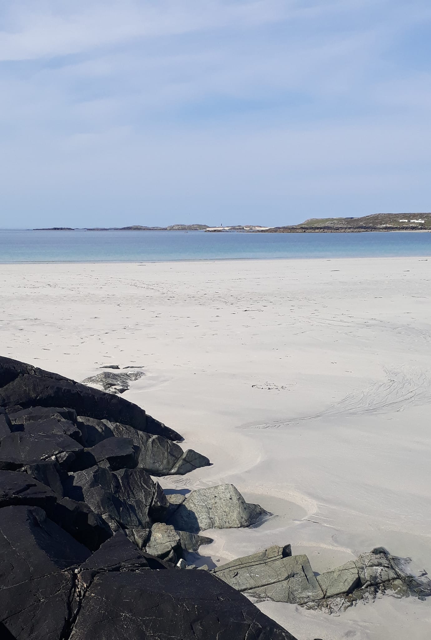
So far it’s been perfect running territory along the strands and soft sandy grass. Suddenly though just before I reach Doonloughan Pier the shoreline becomes very rocky, and I struggle for a while over wobbly boulders and seaweed. There’s a man at the harbour so I ask him for directions. He thinks I’m canoeing first and then wonders where I parked – obviously not many runners make it down this far! I follow the country road inland and after about 3km I take a right turn along a rough boreen. I might not have spotted this turn if I didn’t meet a lady at her house who kindly gave me a bottle of water too. I needed it.
The country lane doesn’t look like it will lead to anywhere, but it does take me to Connemara Golf Course on the south side of the peninsula. Apparently this is a 27-hole course and is one of the toughest courses in the world. I run through a couple of fields and arrive at another impressive beach. It’s no co-incidence that it’s low tide as I planned today’s adventure to take advantage of the sandy beaches. I can now see in the distance the two light houses on Slyne Head. Only the western one remains active. Slyne Head is one of the few places in the west of Ireland where the Vikings visited.
 |
| Horses near Horse Island |
I run along the sandy shore which on google maps is called ‘Granny’s Beach’. I meet a group of horse riders along here, near the aptly named, Horse Island. I’m struggling now and envying those horses with their four long legs. The shore becomes rocky but I’m able to run along a grassy path for a while before climbing a gate and reaching Bunowen (foot of the river). The ‘Connemara Smoke House’ is here beside the harbour, and I’ve heard that there’s an interesting tour, explaining how salmon are caught, prepared and smoked. Yes I think I’ll be back to sample some of their fish.
 |
| Bunowen Beach and Harbour |
I stick to the road for the rest of the run into Ballyconneely. I pass Doon Hill which I’ve read was once an extinct volcano. The watch station at the top was manned in both World Wars to check on any possible enemy invasion. At the foot of the hill is Bunowen Castle. I was told later by Joe Joyce, at the B&B where we’re staying, that this building was not that old and replaced an earlier Grace O’Malley castle.
 |
| Doon Hill |
I carry on running towards Ballyconneely and I have a nice surprise as I realise I'm running on the road where our guest housed is (Teach an Easard). Its about a mile outside the village. Maureen and Brian have just arrived at the B&B so it’s a perfect ending to today’s adventure.
Stage 73- Revisited: Saturday 13 August 2022 Slyne Head, Co. Galway: 9.13 km or 5.67 miles

When I initially did Stage 73 on 2nd June I had come along a boreen from Doonloughan Bay that brought me to the Golf Club, but I hadn’t reached the SW corner of this peninsula. So today I felt I needed to get closer to Slyne Head, which is on the western tip of a group of islands. The most westerly island is called Illaunamid (Oilean Imill or Wood Island) and this is where two Slyne lighthouses are situated.
 |
| Connemara in all its glory with twelve pins in distance |
Today was extremely warm and I had already run around Cleggan Cliffs (another re-visitation!) earlier in the morning. I then drove to this area and parked my car just before the Golf Course and started my run (or walk) at 11.33am. ‘Mad dogs and Irishmen’ might have been an apt phrase for me today in the Connemara midday sun! To be honest I didn’t really do much running as I passed beach after beach in this beautiful area. Even on a perfect Saturday like today there were few people around. I tried to stick strictly to the shore.

At the caravan park I had to climb up from the strand to get around a rocky and tricky cliff section. Eventually I reached the SW corner of the peninsula. The beach here was completely deserted. As I got closer to Slyne Head I met a couple who had been snorkelling nearby. They were Eimear and Pat Irwin from Belmullet.
 |
| Another deserted beach near Slyne Head |
 |
| With Pat Irwin from Belmullet |
I explained about my adventure and told them about how I was so impressed with the beauty of the Mullet peninsula when I was there last summer. I carried on running/walking and soon I could see the lighthouses on Slyne Head. There are two lighthouses on Illaunamid island, and both were built in 1836. Only one of them is now in use. Since I’ve started this whole adventure in 2017 this is the most westerly point I’ve reached. It’s still a very warm sunny day but I can hardly feel a breeze, even though in this corner of the peninsula, I’m now surrounded on all sides by the Atlantic Ocean.
 |
| The closest I could get to the lighthouses on Slyne Head |
The Vikings from Iceland were regular visitors to this area and in fact it was a shorter and more convenient journey for them to get to Slyne Head, compared to the longer distance from Iceland to Scandinavia. As well as being strong oarsmen, the Viking boats had a large sail made from wool that allowed the boat to move as quickly as sixteen miles per hour. They even had their own name for Slyne Head, calling it Jolduhlaup.