Wednesday, 16 August 2017

Nana-korobi, ya-oki 
       (Fall down 7 times, get up 8 times). 

<Author: Gerry O'Boyle>

Saturday 12th August 2017

Stage Seven: Portaferry to Donaghadee (approx 53k or 33miles)


We continued our challenge today, starting in the village of Portaferry and now running along the east side of the Ards Peninsula. I deliberately used that word ‘challenge’ (rather than adventure) because sometimes we forget how hard this task can be.

Today’s starting team
Our main team of three (Helen, Sean and I) were delighted to be joined once again by Claire Garrad & Philip Mulligan and also Sarah Benton who is with us again for the third time. We welcome especially Lindsay Doulton who joins us for the first time. Lindsay is a regular parkrunner, a Fulham supporter and despite now being a young mother, still hasn’t lost any of her fitness.
Starting team at Portaferry


It was an early start, leaving Portaferry at 7.45am. This was so we can make the most of the low tide and the lovely sandy beaches on this part of Co. Down. Today it seemed as if we were running all day long on mostly sandy surfaces and it gives me another excuse too to quote those lovely lines from De Profundis by Oscar Wilde ‘’the sea was for the swimmer, and the sand for the feet of the runner’’. 

We had some sunshine and rain during the morning but not really a lot of either. Still, it was a perfect day for running, never reaching more than 17 degrees and with only a slight north wind blowing in the faces of the seven of us.   

Anyway, we leave Portaferry and run south (yes South, as we’re heading towards Ballyquintin Point at the very bottom of the Ards Peninsula). Remember, we’re rigidly following the coast. It’s a lovely quiet country road from Portaferry and after about 3 miles we see a National Trust road/lane on the right leading back down towards the coast. We’re at Bar Hall Bay now and we stick to the coast even when the lane/path fades away. The path leads us to the very bottom tip of the Ards Peninsula at Ballyquintin and shortly we ‘turn the corner’ and head north now with the Irish sea on our right hand side. At Ballyquintin Point we find a lovely grassy path which we follow for a mile or two. The seven of us have the whole world to ourselves here and we haven’t seen anyone else since we left Portaferry. However, after a while our grassy path disappears and suddenly we’re clambering through a rough area of sinking soft grass, trying to avoid the nettles. 
Gerry and Claire at Ballyquintin Point
Scrambling through the nettles


In the distance we see a cornfield and when we reach the field we notice a very narrow path which guides us nicely through the cornfield without causing any damage to the crop. We eventually leave the cornfield and come back onto a country road passing lovely secluded beaches at Millin Bay and later at Knockinelder. The tide is out fully now so we drop down to the expansive Knockinelder beach running onto the strand and staying on the shoreline.  Just after Knockinelder, we pass a beautiful showpiece village called Kearney which has been restored by the National Trust. There is evidence of life and activity here going back over a thousand years and the old Slans Graveyard is nearby. The village of Kearney itself was used recently as a setting for a film ‘My Mother and Other Strangers’ set in WW2.    


Sean, Gerry and Claire at Kearney

Cloughey and Portavogie

Cloughey Beach
To travel by road by Portaferry to Cloughey is 5 miles but it took us (strictly coastal runners) 14.5 miles to get here. It’s another beautiful and long beach at Cloughey and with the low tide, perfect for the feet of us runners.

Gerry and Claire silhouetted at Cloughey Beach
Much like a cat among the pigeons - Philip among the seagulls!
Farewell to Lindsay and Claire at Cloughey

We are sad to say goodbye to Lindsay and Claire and now there are five of us left. We continue through the sand dunes and bushes at Cloughey. Even though it’s still early August, we notice the blackberries are already ripe.


Losing Philip in the high ferns!


At Portavogie they’re getting ready for a Seafood Festival here but unfortunately we haven’t time to wait. Also at Portavogie, we should note that in his later years Georgie Best and his wife Alex moved here for a much quieter life.


shipwreck on Portavogie beach
 Just north of Portavogie we pass Burr Point, the most easterly point on the island of Ireland. Looking out to sea in the distance we can the Isle of Man towards our right and Scotland on our left. Sean also points out the mountains straight across in Cumbria (Lake District) which we can just about make out.

Gerry going west!

Sean, Philip, Helen and Sarah at Burr Point


Remembering Lisa
Next we come to the village of Ballyhalbert and as we run along the beautiful strand opposite the many caravan sites we are reminded of a tragic day over twelve years ago. The day was 28 February 2005 when a young lady called Lisa Dorrian went missing. It’s believed she was murdered here at Ballyhalbert but her body has yet to be found.


After Ballyhalbert, the shore is rough and rocky and reluctantly we have to move up onto the main A2 for a few miles. However, we’re soon down on the shore again and now we can now see the church steeple of Ballywalter in the distance. It’s another long (very long!) sandy beach all the way into the village. I can feel my legs getting heavy now - this sand is hard work for the feet (and legs) of the runner! I think we were all glad to have a wee break at Ballywalter (formerly known as Whitkirk).
Farewell to Philip at Ballywalter

At Ballywalter we notice that we’ve now done 24 miles and at this stage Philip (who earlier parked his car here) decides to call it a day. Four of us carry on. We’re delighted that Sarah is staying with us and today. Good on ya Sarah! 
Sarah, Gerry, Sean and Helen at Millisle

I think it was about a mile before Millisle when it happened. I hit the wall! I struggled on for a while and managed to get as far as Millisle village. We stopped at a wee shop for coffee, drinking it as we walked towards our final destination in Donaghadee. I finally regained and recovered myself. Soon we were running again and shortly we reached ‘The Commons’, a lovely green area outside Donaghadee.

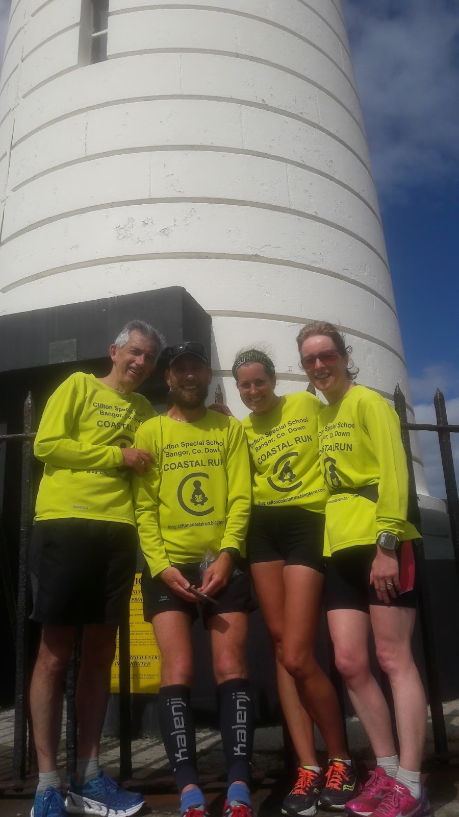
Then we spotted it in the distance – and yes there it was - and never was I so glad to see it -that iconic Lighthouse in Donaghadee. We even had a welcoming crowd to spur us along as we ran down to the Lighthouse at the end of the pier. Melanie Patton (another friend from NDAC), Claire (who ran with us earlier) and their lovely children were all there clapping and cheering us along the pier. Melanie even produced orange juice and delicious donuts (or gravy rings as they’re called in N.Ireland!).  Just what we needed after 33 miles!
Helen and Sean run to the lighthouse
Supporters on the right cheering us in!


Next stage starting point - the door of the Donaghadee Lighthouse

Sarah and the welcoming party!


Once again Helen rounded off another great day with a swim in the sea ......and so our adventure continues.

Now I should say that there are strange rumours going around that say our Coastal Run might not end at the River Lagan in Belfast on 16 Sept.  Yes, maybe we’ll go a little further on after that and try to complete the whole N.Ireland coast. (Antrim and Derry) Watch this space!


Total distance to date: 282k or 176miles      


Next leg (final Co. Down stage): Saturday 16 September (Donaghadee to Belfast)

If you’d like to Donate to Clifton Special School, please see below. https://mydonate.bt.com/events/cliftoncoastalrun/381290

Tuesday, 25 July 2017

"Running doesn't build character, it reveals it." 

Sunday 23 July 2017

<Author: Gerry O'Boyle (photos by Helen Byers, Gerry O'Boyle and Monica Savage)>

Stage Six: Comber to Portaferry (approx 40k or 25miles)  

We continued our adventure today in the village of Comber and keep following the ‘coast’ of Strangford Lough. This is our first run on a Sunday- all the others have been on a Saturday – and we’re hoping the roads will be quieter this morning. We were glad too to get a short piece on Radio Ulster (Your Place and Mine) yesterday morning – good publicity for our cause!

Today I’m wearing my Clifton Hoka shoes which have been kindly donated by Pure Running. These are really amazing shoes – they literally give you a spring in your step, which is just as well because I need all the help I can get to try to keep up with Helen and Sean! So thank you Pure Running. Also, I think the name, Clifton Hokas shoes fit perfectly with our Clifton Run.  

Today’s starting team
Our core team of three (Helen, Sean and I) were delighted to be joined today at the start in Comber by Samantha Eakin, Debbie Matchett, Valerie McDonagh, Claire Garrad, Rab Martin and Philip Mulligan. 
I got to know young Samantha (Sam) recently – she works in StreetLife and always has a smile on her face. Debbie is my physio person and to be honest I don’t think I’d be doing this coastal run if it wasn’t for her special treatment earlier in the year. Valerie is a Tipperary girl and of course she is the excellent Chairperson of N.Down Athletic Club. Claire is a relative newcomer to running since returning to Bangor but is learning fast and building up her miles. Rab is a marathon runner and still turns out to play rugby for Donaghadee -not bad for a 49 year old! And last but by no means least, is Philip - really the life and soul of any group.         

 
The starting team!

The weather was dull enough to start with and Scrabo Tower/Hill was covered in an early morning mist as we drove towards today’s starting point. It was an earlier start today and we leave Comber to start our run about 7.40am

Comber–the gateway to everywhere
Comber was once a very busy hub for three railway lines, Belfast to the west, Downpatrick and Newcastle to the south and Newtownards to the north – and today we’re heading north towards Newtownards. I read somewhere that there was once a railway level crossing at Glassmoss (just outside Comber) that was ‘operated by the Byers family for years’ – no doubt ancestors of our own smooth operator, Helen Byers!  

The mist is clearing and as we’re running along the Comber-N’Ards road we have lovely views of Scrabo Hill and Scrabo Tower on our left hand side. It’s nice to note that Scrabo Tower (now just reopened) was built to honour Charles Stewart who was held in high regard with his attempts to alleviate suffering during the Irish Famine (one of the very few, kind and generous landlords of that time)   
The mist lifts off the top of Scrabo just as we run along the Floodgates path

Floodgates Path
After about 2.5 miles outside Comber (halfway between Comber and N’Ards) we take a right turn through a farm-gate, leaving the dual carriageway and joining the Floodgates path. This is a beautiful stretch, completely traffic free, although we are really running close to the flight path at Newtownards Airport! We are lucky that we’re running here in the early morning as we notice that today there is an Open Day at the Ards Airport and it’s advertised as being ‘perfect introduction to aviation for any budding pilots’ -yes maybe best to get through this path as quick as possible! 


Sadly, we say goodbye to young Sam and we shortly emerge from the Floodgates path onto the Portaferry road just outside Newtownards. We continue south and although we’re on the main Newtownards-Portaferry road we have a nice footpath to run on almost all the way as far as Greyabbey. It’s warming up now and just before Greyabbey we stop briefly at Mount Stewart for drinks and toilet breaks.
One of the glacial deposits on the approach to Mount Stewart
Greyabbey
We learned that the Abbey here was the only Cistercian monastery in Ireland to be founded by a woman. Affreca established the Abbey here in 1193. A few centuries later in 1798 the United Irishmen, mainly inspired by protestant liberals were defeated here and because of this, the men of the village were given the name ‘the green boys o’ Greba’. So it’s only right we’re wearing our (lime) green shirts as we run through Greyabbey! 


Claire leaves us at Greyabbey and now there are seven of us left. Unfortunately after this, we have no footpath for a little while but we struggle along on the main road and eventually we arrive in the quiet village of Kircubbin. (known as Cubinhillis in medieval times). 

It’s beautiful now in Kircubbin with lovely views across Strangford Lough to Whiterock and Daft Eddies (see also stage Five!) and we can still see Scrabo Tower in the distance. Maybe Kircubbin is a little too quiet though as we’re looking for somewhere to have some coffee and scones. Eventually we have to settle for a supermarket. At this stage Debbie, Valerie, Rab and Philip have to leave us. We really appreciated all the extra company on our coastal adventure today. Oh, almost forgot, Valerie was approached by a man in Kircubbin –he donated £5 to Clifton School. 
 
Rab, Debbie, Valerie and Philip in Kircubbin


Gerard meets us on the road and
leads us to Abbacy Road
So Helen, Sean and I proceed (skipping the coffee) and after about two or three miles south of Kircubbin we pass the Saltwater Brig Pub (I’m feeling thirsty all of a sudden!). On and on and then another mile or two of twisty roads south of Kircubbin we pass the townland of Ardkeen. Shortly after that we take a sharp right hand turn off the main road and enter Abbacy Road - glad to be on a much quieter road. Here we had arranged to meet Gerard Adair (a relative newcomer to N.Down AC). Gerard takes us to his friend Sharon Fitzsimons’s house nearby (Sharon also happens to work with my wife, Maureen). Gerard and Sharon have arranged a lovely spread of tea, cakes, biscuits and delicious banana bread. Maureen, our wee Brian and Sharon’s daughter Ciara (recent All-Ireland Camogie Champion!) join us too. Also, Sharon’s friend, Monica Savage arrives and kindly gives a donation of £20.00 for Clifton School. Thanks Monica.     


The first all Ireland
Camogie Champion
we've encountered
on our journey so far!

Lovely spread and stunning view from Sharon's house


After about half an hour, we reluctantly leave Sharon’s house and continue along Abbacy Road with Gerard joining us for the last six miles into Portaferry. The sun has come out now and we continue along Abbacy Road (nice quiet country road) which joins up with Marfield Road and eventually reaching the shore of Strangford Lough. Along the way we bump into Buzz Lightyear, just escaped from last week’s Portaferry festival! We’re getting very tired at this stage but Gerard keeps us stimulated and distracted with his local knowledge, pointing out various fish and turkey farms. Soon we see Castleward (on the other side of the Lough) in the distance. Even if we are tiring, it’s still a beautiful run in along the shore to Portaferry and we finally come to our finish line at the ferry port.  
Running up the final hill of the day - fresh Gerard
1.5miles into his journey the rest of us at mile 22!

Flowering Rapeseed plants on the Abbacy Road

Strangford Lough from the Abbacy Road

Mussel Farms set up by Queen's University as part of the
Hydrodynamic Modelling Framework for Strangford Lough

View of Castleward and Audley's Castle

First glimpse of Portaferry


It’s warm and sunny now as we complete today’s run and Helen can’t resist the temptation to jump into the sea. Gerard and I are even brave enough to go for a paddle – and that salt water is just what our bodies and feet need after running 25 miles! And so, Stage Six of our coastal run is complete – the adventure continues.


Watch it here
Total distance to date: 229k or 143miles       

Next two legs: Saturday 12 August (Portaferry to Donaghadee) and Saturday 16 September (Donaghadee to Belfast)

If you’d like to Donate to Clifton Special School, please see below. https://mydonate.bt.com/events/cliftoncoastalrun/381290

Tuesday, 20 June 2017

A good run is like a cup of coffee - I'm much nicer after I've had one.

Saturday 17th June

<Author: Gerry O'Boyle (photos by Helen Byers, Gerry O'Boyle and Gavin McDonnell)>

Stage Five: Strangford to Comber (approx 57.5k or 36.4miles)   

We started our adventure today in beautiful morning sunshine in the village of Strangford. We could of course have crossed over on the ferry to Portaferry (about a mile or 8 minutes across) and continued our run along the east side of the Ards Peninsula. However, we decided not to take the easy option as we are trying to strictly stick to the coast.

In fact Strangford Lough isn’t really a lake – it’s actually a salty sea inlet - the largest sea inlet in the British Isles and we’re going to run all the way around it (anyway, it only adds an extra 60 miles to our journey!)  The name Strangford comes from the Old Norse word – ‘strong fjord’ and it’s also the original home of King Magnus (bare legs). Magnus would have been very proud this morning to see all the barelegged coastal runners. 

Our core team of three (Helen, Sean and me) were delighted to be joined by a few more runners today. Simon and Keith joined us later in the day but Jill and Sarah – the first runners to come back again for more – started together with us in Strangford. So, it’s ‘Five go for a wee run’ as we set off on a beautiful midsummer’s morning. Yes, the weather is perfect and even at 8.00am the sun is high in the sky and already it feels nice and pleasant at 16 degrees.


The Squeeze Gut in Strangford
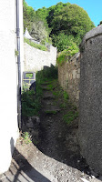
The Squeeze Gut
We’re really enjoying learning about new places as we make our way around the Co.Down coast. Today is no exception and straight away we discover a narrow pathway at the very top of Strangford at the end of Castle Street. There is a small gap between the Old Court Office and the last house on the hill and this gap on the left leads to a narrow walled pathway with low flat grassy steps. It’s known as the Squeeze Gut. It was built during the Irish Famine in 1847 to provide

Gerry and Sean
attempt to squeeze through
employment relief. It was said that the Squeeze Gut was named because farmers used to drive their cattle to the ferry this way and larger beasts had to squeeze through.  However, our slim running team had no difficulties squeezing through these narrow walls, although we decided to go single file just in case!
Catapult time!
Jill runs through
the seaweed
We exit from the Squeeze Gut on the other side of Strangford. We’re still in a wooded area and after a while we see a sign for the ‘Ulster Way’ which brings us down to a rocky, seaweed shore. Sarah made a point about this coastal adventure that ‘you never know what’s around the corner, but that’s all part of the whole enjoyment’. We stick to the coast and struggle along the muddy shore (there’s no proper coastal path here) and eventually we come out onto the main road. So after about 20 minutes we’re still hardly a mile outside Strangford. At least we’re going in the right direction! We’re lucky now to have a footpath to run on and very soon we reach the caravan-park entrance at Castle Ward.


Castle Ward
Castle Ward is one of my favourite places in N.Ireland and I have great memories of being here with my children – we even took my parents and mother-in-law here when they came to visit us in the late 1990’s. The house and gardens covers a massive 822 acres and was originally owned for centuries by the Ward family but on the death of the 6th Viscount in 1950’s the house was presented to the government (in lieu of death duties and taxes) . It’s now a National Trust property and was location of Winterfell and the Whispering Wood in ‘Game of Thrones’. You can even dress up in ‘Thrones’ character costumes from the show – that might have made a nice photo for our blog but we didn’t really have time today! 

Of course our own Sean Nickell is very familiar with Castle Ward. It was here he did his ‘Last One Standing’ running event. Sean completed an amazing 25 laps over a 25 hour period recently. I was going to say Sean could do this stretch in his sleep – well, running for 25 hours he probably did actually do it in his sleep!

Running through the Co Down
version of "The Dark Hedges"
Eventually we have to leave the beautiful Castle Ward Estate at Audleys Castle and we head along Audleystown Road for about a mile until we come back on the main (Strangford-Downpatrick) road. Luckily we don’t have to stay on the main road for very long. We take a right turn down the narrow Myra road. The only vehicles on this country road are tractors – all the farmers are saving hay today! Myra road loops around (we’re following the Ulster way and avoiding the main road) and then we cross over the main road again towards Raholp and Saul. After about a quarter of a mile we take a right turn at Raholp and we soon find ourselves in the historic area of Saul. On such a marvellous day like today, Co. Down is in full bloom. Who needs to travel to the Camino de Santiago when we’ve got this on our doorstep! And we even have the religious experience and tradition here in Saul (Saint Patrick’s country).  

The church in Saul

Saint Patrick/Saul
Allegedly, St Patrick died in Saul on 17 March 461 and is buried in nearby Downpatrick. Tradition holds that St Patrick and his companions landed at the mouth of the Slaney River, a few miles from here, in 432AD. Patrick encountered Dichu, the local chieftain, who gave him a barn for shelter. (The word for barn in Irish was Sabhall, from which we get the anglicised word Saul).

After passing through Saul we continue straight (along Mearne Road) until we come back to the main Strangford-Downpatrick road (we don’t actually go into the town of Downpatrick, even though its only a mile way) We cross over the main road onto Quoile Road and welcome the cool breeze from the River Quoile on our right hand side. We run along a lovely coastal/river path and then we make a very sharp turn to the right at the bridge (Bridge over the river Quoile!) - signposted Killyleagh/Comber.
Helen, Jill, Gerry and Sarah at the river Quoile

Bridge over the Quoile


All 5 at the Delamont
millennium Megalith
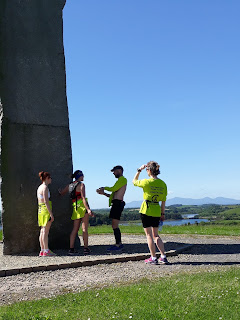
 Although we’re now on the main road towards Killyleagh it’s quite safe as we have a footpath to run on for a mile or two. When we run out of footpath, we continue along the main road (running on righthand side of course!). We are glad to reach Delamont Country Park. It’s getting warmer, we’re all very thirsty and it’s nice to get off the busy main road. We stop for a quick drink at the new cafe in Delamont and then head down towards the shore. There are spectacular views here in all directions – views of the small islands in Strangford Lough, across to the Ards Peninsula and the Mourne mountains to the south look stunning. We pause at the tall Strangford Stone erected only recently in 1999 to mark the millennium. To give it a proper name this monument is called a Megalith – it stands 10 metres high and was quarried from a single granite slab in the Mournes.


View of Mournes skyline from Delamont Megalith
 
View of Strangford Lough from Delamont Megalith
It's a long way up!


Sean explaining how
the granite is mined


We continue our run, following the narrow paths towards the shore and trying to find the coastal path to Killyleagh. I’m not sure where we went wrong (and I hold my hand up here–it looked easier on Google maps!) but after running for about 20-30 minutes we somehow end up back at the entrance to Delamont. So, we’re back on the main road again heading for Killyleagh. After about half a mile we take a right turn down Shore Road (which does what it says and eventually brings us to the shore!). We follow the road around until we reach Killyleagh harbour. We then spot a church steeple and the castle in the distance and run up Irish street to beautiful Killyleagh castle /archway where Simon Robinson is waiting patiently in the warm sunshine to join us. It’s now 11.45 and we’ve already covered 20 miles today. Simon has kindly bought bottles of lemonade for us all and we can’t thank him enough for his generosity. In this weather, it’s just what the doctor ordered!   

I know Simon as part of a ‘Sunday morning Coffee/Running group’. Simon usually takes his lively and friendly dog Otto on our Sunday morning run and now I’m beginning to wish I had four legs to get me through today. It’s warming up now (23degrees) and we welcome our short break in Killyleagh.
Jill and Sarah leave us at Killyleagh
After a 15 minute rest we sadly (for us!) say goodbye to Jill and Sarah and leave Killyleagh Castle heading NW along Shrigley Road. We were reading Terry’s 2013 blog and decided to follow in his (wise) footsteps, stay inland and head towards Shrigley (avoiding the main road) . Conveniently Shrigley road is just alongside the castle.

Shrigley
Shrigley is just about a mile outside Killyleagh but once was a small industrial village which grew up around the large six-storey cotton mill. In 1836, Shrigley mill had more power looms than any other factory in Ireland. However, I read that ‘’between 1968 and 1972 a very extensive redevelopment project was completed involving the replacement of the early industrial village, the construction of 154 houses and two shops. In short, the village as a village was entirely swept away; not one of the original workers' houses remains’’.  

Just outside Killyleagh at Shrigley (after NI Plastics) we take a right turn down Clay Road and continue straight along here. We cross over Tullymacnous road, staying on Clay Road and eventually we come back onto the main Comber road again. We take a left turn on the main road and although there’s no footpath we only have to run for about half a mile when we are able to take a right turn towards the Lough - down Ringdufferin road. We stay on this nice quiet road for a mile or two and then we come to a junction which looks as if it could lead down to the coast. This road is called Ringhaddy Road and this is where it all went wrong! 

Yes, Ringhaddy Road did lead down to the coast but when we went to take a left turn at the shore there was no coastal path and just a house with a big gate, saying Private Property! (we noticed in this area a lot of private/no entry signs). We decided to climb down onto the rocky/muddy shore anyway, take a left and make our way along the rough shore, hoping we would somehow get back onto a trail or country road. We struggled along the muddy/seaweed shore for about half a mile and then abruptly came to a fence that said ‘private property, trespassers will be prosecuted’.

So we now had a dilemma – would we turn back on the shore and run all the way back up Ringhaddy Road or would we chance climbing over the fence and risk being prosecuted (someone mentioned risk of being shot!). We had a third option which we also tried (well Simon did!) -this was crossing the muddy bay! Although it was low tide, there was still a narrow stretch of water to cross and lots of mud/quicksand. Simon volunteered to cross but soon was deep knee in mud before he’d even got half way!


We didn’t take this option and decided to reluctantly head back along the shore. However half way back we discovered a small entrance off the shore onto a lane. At this stage we didn’t realise we were on a private lane. Soon the owners of the property confronted us but Sean quickly defused the situation, explaining what we were doing and the landowners let us continue running on their lane. We quickly joined up with Quarterland road and then Ballymorran road (this was the road we should have taken in the first place!!)                

We followed Ballymorran Road all the way for a mile or two until we came to a T junction and then took a right turn towards Whiterock. After about a mile we arrived down on the coast at Whiterock harbour. At this stage something seemed to urge Helen on – she perked up and starting talking about beer! I wondered why at first and then realised she could see the ‘promised land’ across the bay! And yes, there it was indeed; less than a half a mile away, Sketrick island and the pub ‘Daft Eddies’. 
After just 28.4miles, we arrive at Daft Eddies!
Welcome to Keith "Cheers"!

We were now totally exhausted but were delighted to meet two fellow runners (Gavin McDonnell and Keith Gilmore) here to complete the last 7 miles into Comber with us. Not only did they welcome us but they provided us with well-needed fuel (orange juice and snacks) to revive us. After our earlier exploits we arrived an hour or two later than expected at Sketrick island and apologies, especially to Gavin who had another commitment in Belfast and wasn’t able to run the last part with us. Thanks so much for coming to Daft Eddies (and for the refuelling snacks!) Gavin and we know you’ll join us at one of our next stages.   

Helen and I had a pint of shandy each and were feeling so tired that we discussed finishing this stage at Daft Eddies. (28 miles seemed enough for one day!)  Simon and Sean though were very keen to complete the stage into Comber and Keith Gilmore was rarin’ to go too (although Keith just celebrated his 40th birthday last week, he’s running remarkably well for a man of his age!) Anyway, Helen and I lost the vote 3-2 and so five of us continued into Comber.

Getting closer...
Closer still...
We've arrived!

We seemed to be running for a quite a while when we came across a signpost that said – Comber 6 miles and then after another half a mile another sign said the same, Comber 6 miles. I think I must have hit the wall at this stage – and I don’t think that pint of shandy in Daft Eddies did me any good either – although Helen’s pint seemed to give her a second wind! For the last few miles my legs were so heavy, so it was walking, running, walking ....with Sean urging me on and eventually we arrived in Comber. And so, Stage Five is completed – the adventure continues!  


"This is the best sandwich I've ever tasted!"


Watch it here
Total distance to date: 189k or 118 miles Next leg: Sunday 23 July (Comber to Portaferry)    

If you’d like to Donate to Clifton Special School, please see below. https://mydonate.bt.com/events/cliftoncoastalrun/381290