Keep your eyes on the stars, and your feet on the ground. T Roosevelt
Stage Nine: Belfast to Islandmagee:
Claire & Gerry: 40k or 25miles
Helen & Sean: (via Waterworks parkrun) 48k or 30miles
<Author Gerry O’Boyle>
Saturday 7 October 2017
We started our run today in the city of Belfast which really
borders two counties, Co. Down on the east of the river and Co. Antrim on the
west side. We’ve already completed all 200 miles of the Co.Down coast (from
February to September) and this morning we crossed the Lagan to complete the
rest of N.Ireland.
Helen, Sean and I were delighted to be joined in Belfast by
Claire Garrad (Claire’s fourth run with us). So, the four of us start together
at 8.45am at the new Titanic building. It’s quite busy in the Titanic Quarter even
at this time of the morning and really great to see this whole area being
revitalised. The weather is dull but at least it’s not raining as we set off on
today’s adventure.
 |
| Gerry, Sean, Helen and Claire in front of SS Nomadic |
Once we cross the river, we take a right turn, passing the ‘Big
Fish’ or ‘Salmon of Knowledge’, remembering the story of how Fionn McCumhaill
got his wisdom. We’re heading north now and we go under the M3 Motorway and
come to Donegal Quay.
 |
| Sean gains some knowledge |
Sailortown
We pass through the old docks area of Belfast, known locally
as Sailor Town. A local guy, Anthony Tonor wrote a great song in 2010 about
this neighbourhood (called it Sailortown of course!) and started singing it in
the nearby Rotterdam Bar.
‘The walls in the city
have a lot to say, about the UVF and the IRA but these walls say nothing about
who I am, when I’m singing in the garden at the Rotterdam, doing Brown Eyed
Girl and Whiskey In The Jar.’
At this stage Helen and Sean head across to north Belfast to
the Waterworks parkrun and Claire and I continue through Sailortown. Before our
team separates, Helen reminds us to take a picture of Sinclair Seaman’s
Presbyterian Church, a church built as a haven for sea merchants.
 |
| Built in 1856 -Sinclair Seaman Church is a historical maritime building of worship |
 |
| Art on the wall of Creed Café - Sailortown |
Claire and I continue along Corporation street, which leads onto Garmoyle St, Whitla St and Duncrue Street. At a wee roundabout we take a left and then a right into Duncrue Road. After a while we cross-over Dargan Road and at last we join the Cycle/Walk path with the M2/M5 Motorway close by on our left. This is actually part of the route of the Belfast Marathon. We pass Hazelbank Park and even when we get to Gideons Green, we still have a promenade and wide footpath to run on. The sky is very grey now and we struggle through the showers without getting too wet. We pass Jordonstown, Greenisland and eventually we arrive in Carrickfergus. Claire measures it as 11 miles so far and we can relax now knowing we still have to wait for Helen and Sean to arrive.
 |
| Looking back toward Belfast docks from the M2 towpath |
 |
| Helen and Sean had to cross the motorway before running alongside it |
 |
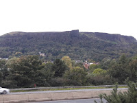
| Cavehill (Napoleon's nose) and Belfast Castle view from the M2 towpath |
Carrickfergus
 |
| Sean of Orange... |
Claire and I had arranged to meet Helen and Sean in Creeds
Cafe in Carrick and we just manage to get into the cafe before the heavy rain.
We get nice seats on high stools by the window, drinking our tea and coffee. Eventually
we spot the two lime green shirts (and Helen’s new pink shoes!) in the
distance. In Creeds Cafe we also get talking to two runners and we tell them
our story.
We leave Carrick and we’re still able to run by the shore on
a wide footpath. About a mile after leaving Carrick we take a right turn
at Magills Avenue and arrive at what once was a separate village (and strangely
named!) Boneybefore. Apparently in 1760 French soldiers were told that this
village was ‘a bonny wee place just
before Carrick’. This was where US President Andrew Jackson’s parents lived.
 |
| Claire and Gerry at Carrick Harbour |
 |
| Claire and the stone snail(?) at Jordanstown |
 |
| Carrick Castle |
President Jackson
Andrew Jackson served as the seventh US president from 1829
to 1837 and was involved in what is believed to be the first attempt to kill a
sitting President when someone aimed a pistol at Jackson, which misfired. Luckily
for the president the brave Davy Crockett happened to be there and restrained
and disarmed the culprit.
We continue here close to railway line (and away from the
main road); and then along by ‘Old Turn’ road which leads to Loughview Drive
which turns into a rough (and flooded) path. We arrive back out on the main
Whitehead road at the village of Eden. Nobody said this adventure was going to
lead us to Paradise but today we did reach a place called ‘Garden of Eden’. We
couldn’t resist a good photo opportunity here and Helen even popped into a
local shop to buy some apples.
 |
| Gerry, or Adam as we called him ;) |
 |
| Apples in the Garden of Eden! |
 |
| Bla hole, Whitehead |
 |
| Bla hole looking towards Belfast port |
 |
| Whitehead train station |
 |
| Whitehead train station bridge |
 |
| running towards Blackhead Lighthouse, Whitehead |
 |
| Sean, Claire and Gerry at Blackhead Lighthouse |
We leave the Lighthouse and run downhill along a narrow (almost traffic free) road called McCraes Brae. We soon join up with the ‘main’ Ballystrudder road and take a right, heading north into the heart of Islandmagee. Somehow the conversation turns to ice-cream and Claire and Helen have heard rumours that at ‘The Rinkha’ in Islandmagee they do the best ice-cream in N.Ireland. Yes we’re now on the Peninsula of Islandmagee and after about half a mile we take a right into Middle Road and spot ‘The Rinkha’ in the distance and of course we stop for ice-cream which definitely lives up to its reputation! We cross the road here in Ballystrudder and call to the Gobbins Visitor Centre (the actual Gobbins cliff path is closed already for the winter). We continue on and, just after we pass Ballystrudder we take a right turn into Gobbins road.
 |
| The ice cream that the thought of sped up the previous 2 miles! |
 |
| Halloween at the Rinkha! |
The Gobbins
The Gobbins is a cliff-path on the east
side of Islandmagee. It runs across bridges, past caves and through a tunnel.
The Gobbins was created for the Belfast Railway Company and first opened to the
public in 1902. Advertisements of the time declared ‘the new cliff path with
its ravines, bore caves, natural aquariums ... has no parallel in Europe as a
marine cliff walk' ...but the railway company got into financial difficulties
and the path was closed in the run up to World War II. However, from 2011-2015,
Larne Borough Council led a project to reopen The Gobbins. A series of new
bridges and galleries were constructed and installed during 2014-15.
 |
| Our view of the Gobbins |
 |
| Claire, Sean and Helen enjoying the sunny views over the Gobbins and Copeland Islands |
 |
| Image of the Gobbins - not taken by us, we didn't get that close! |
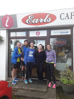
It’s a long hill and tough climb up the Gobbins Road (and my legs are letting me down again!). However the sun has come out now, the sky and sea are blue and when we reach the top, there are lovely views of the Gobbins cliff path just below us. After about another 3 miles along Gobbins Road we eventually come to a T junction. We take a right turn into Middle Road and finally reach our destination at Earls Cafe, Mulloughboy. The proprietor at Earls is Shalana, who has a friendly welcome for us and we are glad to tuck into some nice homemade food. (Shalana also makes a donation to Clifton School). We tell her we’ll back in 5 weeks time for the start of Stage 10 of our coastal run.
 |
| Gerry, Sean, Claire and Helen with Shalana after a good feed in Earls Cafe |
Next leg: Saturday 11
November (Mullaghboy, Islandmagee to Carnfunnock, Larne)
If you’d like to
Donate to Clifton Special School, please see below.


No comments:
Post a Comment