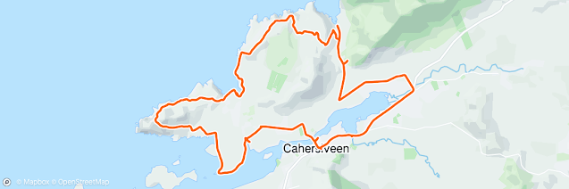
Stages 113-115: Co. Kerry: Killorglin to Cahersiveen: June 2025:
Not only is my friend Donald Smith running with me, but he is also doing all the driving over the weekend. We’re staying in the village of Glenbeigh and over these three days our plan is to cover the northern shore of the ‘Ring of Kerry’ which has various kinds of terrain. This area is officially called the Iveragh Peninsula. On the north-east side of the peninsula, it’s quite flat with detours down to Cromane and Rossbeigh Strand, but as we get further west the elevation increases and we have to make our way across the hills and over the peak of ‘Cnoc na dTobar’.
Stage 113 Co. Kerry: Killorglin to Glenbeigh:
Thursday 5 June 2025: 41.6km or 25.9miles

‘’Being again on the Ring of Kerry, I am enraptured by the purple hills peaking up among the hanging mists’’ Matt Mooney
We have an early start from Bangor, Co. Down this morning, leaving at 5.10am. With Donald driving we make it all the way to the Obama Plaza in Moneygall (on the Offaly-Tipperary border) before we make our first stop. In 1850 Falmouth Kearney, the great-great-great grandfather of Barrack Obama, left Moneygall and settled in Ohio.
 |
| Meeting the Obamas at their ancestral home! |
After a quick breakfast we leave the Visitor Centre and continue our journey to the Kingdom. We’re privileged that a Kerryman, Matt O’Sullivan is running with us today. Matt lives in Killarney but was born and reared in Glenbeigh. He meets us there and drives us back to Killorglin to begin our run.
 |
| Matt & Donald: My two running companions today |
 |
| By the Laune River in Killorglin |
It’s still a couple of months to the Puck Fair in Killorglin.
The tradition of crowning a wild goat has been going for 400 years. Matt shares the history with us. It seems that hundreds of years ago the local people realised that Oliver
Cromwell’s men were heading to the town because goats started coming down the
mountains, running ahead and away from the army. This acted as a warning and
people in Killorglin were able to protect themselves and their livestock.
 |
| With King Puck in Killorglin |
This event is commemorated in August every year when a goat is taken from the ‘MacGillycuddy Reeks’ and brought to the town. During festival week the animal is placed in a cage on a high stand for three days. The goat is crowned ‘King Puck’ by the ‘Queen of Puck’, who is usually a young twelve or thirteen-year-old girl.
 |
| Love at first sight |
With summers getting warmer there has been complaints from some people about the animal’s welfare. Because of these concerns, the goat has been removed from the cage on a number of occasions. On the other hand, Puck Fair traditionalists are afraid that the festival will die out if the goat is not allowed to be displayed. They argue that when the festival is over, the goat is released back into the wild on the last day, known as ‘Scattering Day’
I found a poem by Stephen Dedalus (probably a fictitious
name) which I thought was very relevant to this discussion.
When Interest in this has faded, the goat is brought down, tired, battered and deflated.
To stop this fair’s untimely demise both activist and landlord must come to compromise
 |
| Planning with Matt our route for today |
We start our run at the statue of the goat, King Puck on the east side of the River Laune. It’s a dull and cloudy day but no real sign of any rain. After about 300 metres, at Nagle Memorials, we take a left turn and cross to the west side of the river over the old railway bridge. Trains ran from 1884 until 1960 on a branch line that came from Farranfore. It was then the most westerly railway route in Europe. The line was extended in 1893 so you could travel all the way from Farranfore to Renard Point which is the ferry connection to Valentia Island. Ironically the train also made it easier to leave rural areas, as this monument in Killorglin portrays. The wooden carving is from a 150 year old oak tree that stood outside Killorglin Railway Station.
 |
| The Diaspora Lady, carved from old oak tree |
 |
| Yes, this is a great definition of what Emigration is |
Matt tells us that one of his early childhood memories was going to see the last train in 1960. It was 30th January and hundreds came out all the way along the railway line. Matt and his family watched the old locomotive on its final journey and describes it to us. ''My recollection of the last train is just going to Carragh Lake Station and watching the train chugging along. I probably didn't understand the significance as much as my parents''
 |
| The Railway Bridge in Killorglin |
 |
| Pausing at the Railway Bridge |
On the bridge we get chatting to Eileen who works at
the local library and shows an interest in our adventure. (A few weeks later I visited Killorglin Library and left a couple of my books with Eileen) Once crossing the river,
we stick to the shore road along Castleconway. However, at one stage we have to
come inland and run around a couple of houses before re-joining the road again.
Even Matt is surprised at this slight diversion, but his local knowledge keeps
us right.
 |
| Remembering the Irish Volunteers at Ballykissane Pier |
Later, the coast road comes to an end, but we rough it, with some difficulty, through a few fields and eventually arrive at Ballykissane Pier. There is a monument here to commemorate Irish Volunteers who lost their lives on Good Friday 1916 when a car that they were driving went in off the pier. The men were part of a team working with Roger Casement and the ship, ‘The Aud’. (see also Stage 105 where I wrote about Casement and his arrival on Banna Strand). All in all, it was a disastrous start to Easter Weekend of 1916.
 |
| Matt and Donald following the River Laune |
After Ballykissane, we continue on a grassy trail. As the river flows into Dingle Bay, we stay on a ridge by the shore. We’re definitely hugging the coast today. It feels as if it could rain but somehow it never really does all day.
 |
| Following the coastal trail |
After a while we do have to come inland and we run on some country roads. We head north towards ‘Cromane’ which is a narrow peninsula and fishing village and now home to Ireland’s largest mussel beds.
The narrow headland of Cromane
could also be called ‘Realt na Mara’ (Star of the Sea) as the
village church uses that name. The local football team are also called ‘Realt
na Mara’ and wear my favourite (and Galway) colours, maroon and white.
 |
| Surprised to see such a big ship at the top of Cromaine Peninsula |
We run to the very top of the peninsula. It’s called ‘The Point’ and from here we are very close to the east side of Inch Beach. Just a few weeks ago I ran around Inch Peninsula. I then got totally confused as I didn’t have my map with me and didn’t realise, that I was so close to this side of Dingle Bay. I’m not sure if it’s possible to do a small loop at the top of Cromane at the pier, but it certainly was not achievable today at a higher tide.
 |
| Tide was too high to cross over |
 |
| Enjoying 'Three Fools' Coffee at the Boathouse Cafe |
 |
| Rock from Cromaine |
At this stage we have to come inland and shortly we cross Caragh Bridge.
 |
| Crossing Caragh Bridge |
 |
| Kerry Flags were flying today |
We’re
very close to Glenbeigh now but we take one final loop down to the coast at the
L11658 at Reenalagane. Along here we pass Matt’s family home, and we
remember Matt’s mother, Mary Lou who only passed away four weeks ago. We run
down to the shore and follow a coastal trail for about 500 metres before
returning up the hill on the L7517 and finally reach Glenbeigh or Gleann Beithe (Birch
Valley). So, a direct journey of 13km from Killorglin, took us 42km to complete
by sticking to the coast.
Stage
114 Co. Kerry: Glenbeigh to Cahersiveen: Friday 6 June 2025: 45.1km or 28.0miles

‘’I’ll sing a few verses both cheerful and free of a Cork young lass and a Glenbeigh Boy. And they called him the Philippine solder’’ Michael Sugrue
Our host at Emir View Guest House, Ann McGillycuddy served up a delicious breakfast for us and as the day and afternoon dragged on, Donald and I began to appreciate that early morning meal. Sometimes it’s hard to get the balance right between on the one hand, getting enough energy and on the other hand, not eating too much that might affect your running. It's just the two of us today. We’re continuing our run on the north coast of the Iveragh Peninsula. Way back in the 1500s the huge Iveragh Estate belonged to the Earl of Desmond. His land stretched all the way from Killorglin to Valentia Island – that’s some farm!
 |
| On Rossbeigh Strand |
 |
| Sometimes you have to stop and admire the beauty |
 |
| Donald surrounded by the Kerry Mountains |
We head north towards Rossbeigh Strand. I’d never been here before, but I did notice beforehand that it looked so sandy on the OS map. Running along this beach lives up to all my expectations. The tide is in our favour too and we make a very wide loop of the peninsula. It’s not always ‘sand for the feet of the runner’ but we are surrounded on all sides by the Kerry mountains. We’re privileged to be in such a special place and no sign of any rain, despite the forecast. Once we reach the most northerly point of the peninsula, we are very close to Inch Strand on the other side of the bay. The jutting peninsulas, Rossbeigh, Cromane and Inch act as a natural barrier against the Atlantic Ocean for Dingle Bay. Now I’ve run around all three of them.
 |
| Running along Rossbeigh Beach |
After leaving Rossbeigh (or Rossbehy) we have to climb a steep coastal road. However, soon we find a trail that takes us even closer to the shore and away from any traffic. This path eventually brings us to a beautiful seaside thatched cottage. We admire the wee house and views across to the Dingle Peninsula, but we are confused as to which way to go from here.
 |
| Seaside Cottage |
 |
| Time to head inland and cut through the valley |
We know we need to head inland, so we climb over a couple of farm gates and follow a very narrow path that joins up with the ‘Kerry Way’. We stay on the Kerry Way for a while but realise it’s taking us further inland. We have no alternative but to join the N70, the main ‘Ring of Kerry’ road.
 |
| Remembering Frank O'Grady killed by fellow Irishmen in the Civil War |
It's never ideal running on a busy road and we need to be extra careful with these few miles. On our left-hand side, we notice the old railway line. There is talk of turning it into a Greenway, but I think that’s a while away yet. It’s a pity it wasn’t ready for us to run along as it would have fitted in perfectly with today’s adventure. Shortly we run under, rather than along, the impressive Gleensk Viaduct which was built around 1880 for the Farranfore to Valentia railway line.
 |
| Gleensk Viaduct that carried trains across until 1960 |
We’re relieved to get off the N70 and onto the much quieter L4015 towards Gortaforia which takes us all the way down to Kells Bay.
Nobody can go down to Kells Bay without humming or singing this beautiful song written by Emma Langford in memory of her grand-uncle, Eamonn Langford.
'Oh, the road stretches out before your feet on the winding way
down to Kells Bay.
And the Golden sunset's like no other, they say,
on the winding way down to Kells Bay'.
Yes, Donald and I are singing away as we run down to Kells Bay. The sun is shining too so the feeling is good, even though we know it's still a long way to Cahersiveen.
'And the fuchsias are blooming so brightly and sweet and the ocean could carry our worries away'
 |
| Emma is right about the fuchsias blooming so brightly and sweet |
We decide that we deserve to take a coffee break here at the ‘Kells Bay House & Gardens’. It’s the perfect place to pause our run, among the palm trees, exotic plants and a gushing waterfall. The owner, Billy Alexander travels the world to source and nurture rare plants and has been a gold medal winner at the Chelsea Flower Show a few times.
 |
| Donald at Kells Bay Strand |
From the beach at Kells Bay,
we follow the narrow coastal road west which eventually turns into a trail. We
have a decision to make along here as to how to reach Cahersiveen. I was
speaking to my friend Sean Nickell last week, and he said there is no on-line evidence
of any runners or hikers following a coastal route along here. All routes seem
to point towards the big mountain in this area, ‘Cnoc
na dTobar’. It would bring us inland a little but at least we know
that it should be straight forward once we reach the top. First
Donald and I just have the simple task of climbing 690 metres with no proper
path to follow! Except for Croagh Patrick (764 metres) which I climbed as part
my Coastal Run during Stage 66 on St. Patricks Day 2022, this will be the
highest point I’ve reached on my coastal runs.
 |
| Taking shelter from a heavy shower |
So how do we reach the top of
Cnoc na dTobar. The shore road we are on comes to an end and we run along a
rough coastal trail. We know that this path will soon disappear, so Donald
suggests that we follow a river/stream inland, up the mountain and use that as
a guide. It’s tough going, especially as we’re climbing the whole time. My
legs are beginning to suffer too. We motor on, looking out for two lakes that
we know we need to pass on our way to the top. Eventually we spot the loughs and
have a wee break. Time to eat my banana.
 |
| Enjoying my banana at Kerry's Glendalough |
The twin lakes are called
Glendalough and not to be confused with Glendalough in Co. Wicklow, the
monastery founded by St. Kevin that became
one of the great centres of learning in 6th century Ireland. I
didn’t realise that Glendalough literally means ‘the glen of two lakes’
Speaking of learning I’m thinking of a quote by Sir Martin Conway.
‘’Each fresh peak ascended teaches something’’
So here we go! After pausing at the two lakes, we have a very steep climb. Donald pushes on and I struggle behind him. At times its ‘hands on thighs’ climbing. At least the weather is brightening up for us, and the sun is shining when we finally reach the top.
 |
| Donald at the top of Cnoc na dTobar |
Cnoc na dTobar is one of Ireland’s sacred pilgrim mountains. It was an important site in pagan times where the harvest festival of Lughnasa was celebrated. In 1885 Canon Brosnan, parish priest in Cahersiveen, built fourteen ‘Stations of the Cross’ along the mountain path. At the bottom of the mountain on the west side there is a Holy Well dedicated to St. Fursey or Fursa and that actually is where the mountain Cnoc na dTobar got its name. It translates as ‘Mountain of the Well’.
 |
| Perfect weather at the top just before the mist embraces us |
We’re feeling good about ourselves at the top of the mountain
when suddenly a blanket of mist embraces the whole area. It all happens so
quickly and dramatically. The temperature drops too. It’s an eerie situation
for us and we have no time to waste. We
quickly start our descent. It’s raining now too but the fourteen stations of
the cross guide us on our way down. Soon we reach Station XI and as we get to lower
ground Donald suggests we take a shortcut and skip some of them. I should point
out that it was Donald’s idea to bypass some of these Stations, apologies to
Canon Brosnan!
It's still a long way down to the bottom and we realise that we’re not going to make the 17.51 bus from Cahersiveen. The next bus to Glenbeigh is not until 20.50 so when we reach Cahersiveen we decide to go for something to eat. We relax for a couple of hours, enjoying drinks and delicious food at the aptly named ‘Kerry Coastal Hotel’ before boarding the 20.50 - the last bus back to Glenbeigh.
 |
| Deserved pints after our long day in the hills |
Stage 115 Co. Kerry: Cahersiveen NW Loop: Saturday 7 June: 36.3km or 22.6miles
''The town it climbs a mountain and looks out on the sea'' From 'The Boys of Barr Na Sraide'
As we only have one car with us, it’s convenient for us to leave it in Cahersiveen and tackle the northwest loop where we’ll circle Killelan Mountain. It's our third day in-a-row running so let’s hope my legs will survive another tough trek over the hills. Donald and I head east along the N70 and just outside Cahersiveen we stop at Carhan, the birthplace of Daniel O’Connell.

As I’m making my way around
the coast of Ireland, I’m always conscious of the fact that I’m walking (and running)
in the footsteps of some famous people. None more distinguished than O’Connell.
I realise that its 250 years since Daniel O’Connell’s birth here at Bothar
Carthan in Cahersiveen. He was born on 6 August 1775.
 |
| Daniel O'Connell, The Liberator, at his birth place |
O’Connell had three nicknames - known as ‘The Liberator’, ‘The Agitator’ and ‘The Great Emancipator’. He committed his whole life to bringing equal rights and religious tolerance to Ireland after the outrageous Penal Laws (in the 16th and 17th century) which imposed severe restrictions on Catholic property, education and prevented Catholics from holding public office or voting. Hundreds of thousands came to see him at his Monster Meetings in the 1800’s. It is estimated that at the Hill of Tara in 1843 one million people turned up to hear him speak, the Times Newspaper reported.
 |
| Donald at Daniel O'Connell's birthplace |
O'Connell worked all his life against the British Establishment but gained huge respect in UK circles. The British Prime Minister, William Gladstone said this about him.
‘The greatest popular leader whom the world has ever seen’.
O’Connell also played a major part in the Abolition of Slavery Act in 1833. I think it was so tragic that O’Connell seemed to lose his popularity and had health issues in the 1840’s, when Ireland needed him most. He died in 1847, often known as the ‘Black 47’, the worst year of the Irish famine.
Donald and I continue running on the N70 for a couple of miles and then take a left turn following the L7528 where we cross the river Ferta which has now reduced to a stream. This country road winds around the townlands of Deelis and Cloghane and soon brings us to ‘Saint Fursey’s Well’ at the bottom of Cnoc na dTobar, where we were running yesterday. We stop to visit the Well.
 |
| At Fursey's Well at bottom of Cnoc Tobar |
It’s good to rest our weary legs and afterwards we continue running all the way down to Coonanna Harbour (or Coomnahincha Quay). We get talking to a farmer here who seems fascinated by our story. We discuss the option of following the coastline from here, but he explains that it’s full of gorse bushes and thistles. We know that on the way down to the pier there was a trail about 400 metres back that would take us across towards Kinard West and Kimego. This was a much more practical and achievable way to reach the coast, even if we had to climb over lots of farm gates on the track.
 |
| Spectacular views up here |
We met no humans along here (but lots of sheep) and yet it was the most perfect walk, hike or run with spectacular views across to Dingle and the Blasket Islands. Sometimes our path disappeared and then reappeared. I presume it was probably a pre-famine trail when hundreds of people lived in these hills in the early 19th century.
 |
| A line of Pre-Christian standing stones |
In the distance we can see Cuas Crom Harbour which seems to be tucked
into a narrow sea inlet. When we reach the cove there are people swimming in
the sea, even though it’s quite cold today. I read that Cuas Crom is a popular
and safe beach with few currents in this sheltered bay. We notice that there is
even the option of a sauna in a building by the harbour. Yes, the idea of a hot
sauna is tempting for Donald and me, but I don’t think we would ever want to leave if
we took this option.

 |
| Tackling the Killelan Peninsula |
We continue and decide to tackle this last peninsula around
Killelan Mountain. There is no easy option this time, no trail or path and we
just have to rough it around the coast. I would not recommend this section to
any runner or hiker. The terrain is full of thorny gorse bushes and those wee
prickles get into your socks, shoes and toes. We thought that circling the
mountain would be easier than climbing it, but it’s still difficult. We’re also
constantly running on a slope on very narrow sheep tracks. Not many have taken this route. Lots of sheep again and our presence is driving
them crazy. We can hardly hear ourselves with all the baaing. It’s a struggle
and three days of running is taking its toll - on me, anyway.
 |
| Hard work trying to get around Killelan Mountain |
We can now see Doulas Head and we make our way down to the south side of the peninsula. We spot the island of Beginish in front of us, not to be confused with one of the Blasket Island also called Beginish. There are no inhabitants on either of the two Beginish Islands. In this part of Kerry, most previous occupants of Beginish seemed to emigrate to nearby Valentia Island. I suppose, if you have that island feeling in your soul, it’s hard to settle on the mainland. And yes we can clearly see Valentia in the distance and a ferry making its way from Reenard Point to KnightsTown.
 |
| Beginish Island with Valentia behind it |
 |
| Deserted House on Killelan Peninsula |

 |
| A room with a view |
More thorny
bushes to get through as we descend the mountain but eventually, we reach the
lane on the south side. We keep running all the way to the shore at Ballycarbery
where we stop for a break. It’s really an opportunity to remove all those
thorns from our feet, socks and shoes. We’ve both been itching and suffering
for the last couple of hours.
 |
| What a relief to rest our feet |
 |
| I lost my map deep in the rocks |
At the beach we’re not sure if we can stay by the shore but we keep to the edge of the headlands anyway. It turns out to be quite a good and 'thorn free' coastal route. We can follow the coast all the way around until we reach Ballycarbery Castle. It’s an impressive looking fortress that was once home to the McCarthys and was built in the 15th century.
 |
| Ballycarbery Castle |
We’re not sure what the inside of the castle
looks like as there is a ‘Private, No Entry’ sign on the entrance
gate. This is very disappointing, not just for us but for all the tourists who
come to South Kerry. It’s not the first time I’ve come across an historical
building in private ownership with a ‘Do not Enter’ sign.
Matt O’Sullivan who ran with us on Thursday told us that
this area was known as ‘Over the Water’ and there was great
football rivalry between here and the townies in Cahersiveen. We now follow the
road into the town. Once we cross the river we have one last detour down to the
old railway bridge. When researching about Cahersiveen, I wondered if it was
possible to walk or run across the railway bridge. Donald and I soon found the
answer. Definitely not. The railway track is badly in need of repair and quite dangerous if anyone
tried to cross the river here. It’s sad really and I hope someday that it is brought
back to life.
 |
| Old Railway Bridge in Cahersiveen |
It reminds me of the stories I heard about the ‘Ghost Train’ that Kerry people travelled on when they went to Dublin, especially for All Ireland finals. The train left Cahersiveen at Midnight on the Eve of the All-Ireland. From the 1920’s to 1959 this was the way supporters went to Dublin. The journey took eight hours as steam trains travelled at a slower pace. The Ghost Train got its name because of its low lighting in the carriages which made passengers look like ghosts. The lonesome sound of the regular whistle from the train added to the eerie atmosphere on board. Having said that, the train connection and Kerry football were both very important for the county. It brought people together especially after the bitter fighting in the Irish Civil War. Kerry is really the home of Gaelic Football, and they’ve won 38 All Ireland titles. The popularity of the sport and the GAA brought both factions of the Civil War together and probably went a long way to healing the very bad feelings in the 1920’s.
 |
| Cahersiveen old Railway Bridge |
In Cahersiveen, we are very pleased with ourselves in completing our adventures. Each of the three days was difficult in its own way. Donald drives us back to Glenbeigh where we shower and head to Ashes/O’Sullivan’s Pub. We are just in time to see the end of the Munster Hurling Final. Lots of Cork people around to celebrate their win over Limerick. After a nice meal in the Glenbeigh Hotel we adjourn to the bar for a few drinks and celebrate our achievements.
No comments:
Post a Comment