Saturday, 30 May 2020

Strangford Islands Stage 6 (the bits I missed): Strangford Islands, Co. Down. Chapel Island, Mid Island and South Island): Sat. 30 May 2020
Running around Ireland - strictly by the coast - and ONCE a Month since Feb 2017.

‘’The central place I call “Z” is in a valley surmounted by lofty mountains. The valley is about ten miles wide, and the city is on an eminence in the middle of it.’’ (Percy Fawcett’s letter to his son Brian about his idea of the Lost City of ‘Z’.)
Taken in our back garden (before expedition!) with sons Brian and Matthew
 Another bit I missed! Yes today I had to backtrack a bit to my adopted home county (Co. Down) to complete this wee 'missed bit' when I did Stage 6 back in July 2017.
Just before heading across the sands to Mid Island
Today was a walk (rather than run) and I was delighted to be joined by my two sons Matthew (who has just finished university) and Brian (who attends Clifton Special School.) Since the lockdown in March, the weather has been warm and sunny and today was no exception. We decided to tackle these islands, starting our walk from a small car park just south of Greyabbey on Strangford Lough. 
No photo description available.
Yes looked like we were walking on water!

In front of Mid Island
Also, we thought it was wise to set out on our journey about 90 minutes before low tide. At the car park in Greyabbey we could already see across the sands to a small cottage on Mid Island. There was no causeway from here, so we just headed in the direction of the white-washed cottage, getting our feet wet as we plodded through the sand and puddles until we reached Mid Island.
Will McAvoy's cottage on Mid Island
Mid-Island
Previously known as North Island and sometimes called Mid Isle. It was home to the Ulster-Scots poet Will McAvoy who lived in the cottage on the island - sometimes Will goes back to give poetry sessions. The island even became more famous recently as Brad Pitt’s movie ‘The Lost City of Z’ was partly filmed here. This film was about the explorer Percy Fawcett who really became obsessed with finding the ‘Lost City’ in the Amazon Jungle. On his eighth and final expedition in 1925 he was joined by his 22 year old son (same age as my son, Matthew!). Their last known communication was on 29 May 1925 (95 years ago yesterday) and the pair were never seen again. Fawcett’s other younger son, Brian who remained in England, spent most of his life trying to find his father and brother.
Matthew and Brian on Mid Island
l can now report that my two sons and I survived our own expedition to the three Strangford islands! Once we got to the cottage on Mid-Island, we took a left turn along the shore and walked along the track until we came to the causeway that took us over to South Island. Mid Island seems to have lots of vegetation/trees but South Island is like one big open field, perfect for grazing (on a lovely sunny day like today) with its thick, lush grass, although we didn’t see any cows or sheep. 
Crossing causeway from Mid Island to South Island
South Island
When we arrived on South Island we took a left turn immediately and then circled the whole island. We thought, when we got to the back (western side) of the island, we could then cut across to Chapel Island but we realised that with soft mud and sand that it was much more practical (and quicker) to come back to the same causeway again that we took from Mid Island. We then walked around the other side of Mid Island (keeping the sea on our left) and eventually we could see Chapel Island in the distance.
Matthew and Brian as we approached Chapel Island 
I was glad I had my son Matthew with me. Sometimes it was tough with difficult terrain and our shoes got so wet along the way but Brian, in fairness to him, seemed content and never complained (or never seemed to get tired) all day.
Once we rounded Mid Island we could see Chapel Island in the distance. There was no causeway from this side, so it was just a matter of ploughing through the sand, rocks and pools of water. We knew we were heading in the direction of the long island which we presumed (correctly!) was Chapel Island. I gave Brian and Matthew some celery and carrots and we munched these as we walked along. I was a bit concerned about the tide as it was now exactly low tide at 11.45am. In hindsight I need not have worried and I think we would have been ok even two hours each side of low tide.
Brian on Chapel Island
Chapel Island
As we got closer to Chapel Island, we veered to the left through the muddy rock pools so that we would arrive on the island on the southern side. We didn’t expect to see an actual chapel on the island but nevertheless it is disappointing to see just a small broken wall of stones where I presume the church had once been! 
All that remains of the chapel on Chapel Island

Matt and Brian on Chapel Island with Scrabo Tower behind


In any case this was the perfect location to either pray or just sit and contemplate life in general. Of course, here right in the middle of Strangford Lough, we are very close to Nendrum (just over a mile across to the other side of the lough) where Saint Mahee had his monastery (on Mahee Island). No doubt the saint and his fellow monks were regular visitors to the chapel here. Matthew and Brian were happy too that we finally had our picnic with (360 degree) views of the Mournes, Scrabo tower and other islands on the lough.

Still we didn’t delay too long as we were conscious that the ‘tide was turning’ and we still had to walk back the full length of the island (almost one mile long) before then taking to the wet sands again. 
On leaving Chapel Island it looked like there was a kind of causeway to follow but it seemed to disappear after about 50 metres.
Leaving Chapel Island
In any case Matthew suggested we walk towards the right (easterly directly) so that we could return to our car quicker. Soon we were back on the mainland and when we reached an old pier, we climbed up the embankment.
Heading home!


Here we found a nice country trail and we were able to walk on it along by the shore. 

That trail soon faded away but shortly we could see the cottage on Mid Island again and soon we were back (where we started) at the car park in Greyabbey and enjoying another (well deserved!) picnic in the warm sunshine. Stage 6 is now complete ...........and the adventure continues!

Total distance today 10.3 km or 6.4 miles      

Total distance to date: 1,748 km (1,086 miles)

Next Stage: County Mayo: Ballina to Killala: Saturday 22 August

Contact Gerry on gerryoboyle@outlook.com or 00 44 (0) 7725613308

Sunday, 15 March 2020

STAGES 45&46 Ballysadare to Ballina                        

                        Stage 45


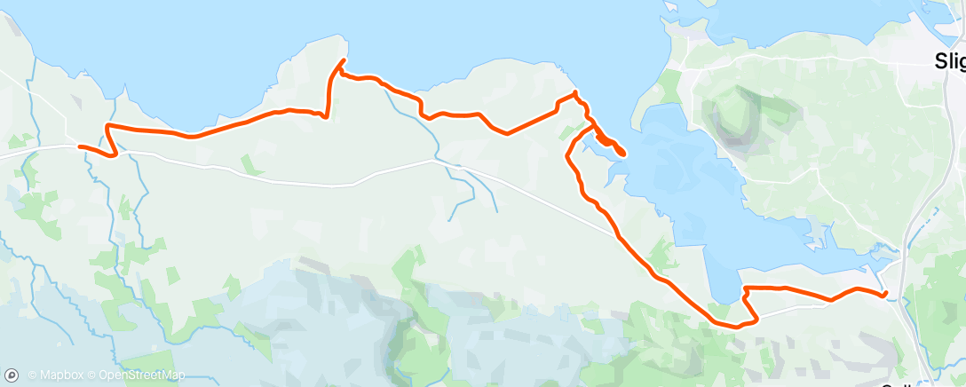
                                Co. Sligo: Ballysadare to Dromore West

                                            Saturday 14 March 2020

                                                40.3 km or 25 miles


‘She bid me take love easy, as the leaves grow on the tree;
But I, being young and foolish, with her would not agree’. (Salley Gardens by WB Yeats)

STAGE 45-46: At the Salley Gardens pub in Ballysadare


I’m travelling on my own this weekend as we were worried about taking Brian away, especially in these worrying times of the Coronavirus. I drove down on the Friday evening, staying two nights in the lovely ‘Twin Trees’ hotel in Ballina. There is an eerie atmosphere in the hotel and I even spotted one guest wearing a face mask.
I started today's run in Ballysadare (town of the waterfall of the oak) where the song ‘Salley Gardens’ originated. You could say WB Yeats co-wrote it. He said it was an ‘attempt to reconstruct a song that he heard an old peasant lady singing in Ballisodare’. I was lucky too that I was able to depend on public transport this weekend as I was travelling between Connacht’s second largest town (Sligo) and the fourth largest (Ballina).


Crossing Ballysadare River 


Ballysadare was originally a major gathering place for all surrounding districts and Saint Columba visited here in 575 AD  'where all the prelates of the neighbouring regions, and vast numbers of holy men and women had come to meet him’.Also, another famous saint, Féichín was born in the townland of Billa in the parish of Ballysadare. 
Leaving Ballysadare I ran along the main Ballina road for about 2km until I came to the sign for Streamstown (at the church and crossroads) and took a right turn. 


Coming back up from Streamstown with Ox Mountains ahead
This was a quiet country road with Ben Bulben still visible in the distance and as the boreen looped around again, the Ox mountains (or Slieve Gamph) came into view. I came back onto the main road again and soon arrived in the village of Beltra (Strand at the Mouth). Strangely too, for some reason, there’s a crater on Mars called Beltra!
View from Streamstown
In Irish mythology, the Firbolg King met his death here after the first Battle of Moytura. 

About 1km after Beltra, I took another right, signposted ‘Coast Road’. I followed this road for about 2km until I came to a crossroads and then I took a right towards Portavaud down to the shore at ‘Gallyhouse Strand’. Here I spotted a man on crutches coming out of the water with seaweed over his legs. I got talking to him (Rodney) and he explained that he had a biking accident and heard that seaweed was a good remedy. I had read too this area was famous for harvesting seaweed. 
Rodney having a seaweed bath!

Rodney and Dell Boy (me!)


The weather now turned wet and miserable as I circled Portavaud Point at the end of the peninsula. Lots of sheep in this area and all protecting their young (just born) lambs.
Sheep protecting new born lamb
I turned back from the Point and carried on running along the shore. However, there were only rocks on the coast now (it was high tide which didn’t help!) so I had to run inland, through a few muddy fields and getting caught in thorny bushes. I was able to get down on the shore again and eventually I spotted a house which led me onto a country road (Derk Road). It was still raining as I made my way up to a T junction where I took a right turn. I continued running on this road for about 2km until I saw the sign for Dunmoran Strand. 


Dromoran Beach
When I arrived on this beautiful beach I was soaked to the skin and I hesitated as I wasn’t sure if I could continue along the shore all the way to Aughris. I debated with myself whether I’d be better following a country road instead. In the end I decided to risk it on the beach and it paid off. (I was probably lucky that the tide was half-way out).
Crossing bridge between Dromoran and Aughris
It was a sometimes a rocky shore but soon I got through it and I was well rewarded as there was a pub (the Beach Bar) at the end. I decided to call into the pub and had a nice pot of tea while my clothes dried by the fire! (I was surprised there were so many people in the pub with all the warnings about the Coronavirus!) 
The Beach Bar at Aughris

Anyway, I got talking to a couple of guys in the ‘Beach Bar’ asking them for directions to Easkey and Dromore West. They assured me I’d reach my destination in ‘no time at all’. I’m always amazed in these situations how non-runners in a pub can over-estimate how fast you can run!
Aughris Pier
After leaving the ‘Beach Bar’, the rain came down again. I soldiered on, following the coast road towards Easkey. I knew the Ballina-Sligo bus only ran every two hours so I was trying to make sure I would get the 2.30 bus from Easkey (or 2.45 from Dromore West). As I got closer to Dromore West I realised I wouldn’t make it on time to Easkey so I left the coast road (just before the big hill) and arrived soaked to the skin in the village of Dromore West.
The sign for Easkey!
At the bus stop in Dromore West I called into a café and ordered a coffee. I had barely got my drink when the bus arrived to take me back to Ballysadare. Luckily, I had spare clothes in my car. It was probably my wettest coastal run since crossing the Foyle Bridge in Derry at the end of Stage 15 back in March 2018.    


                                                     Stage 46


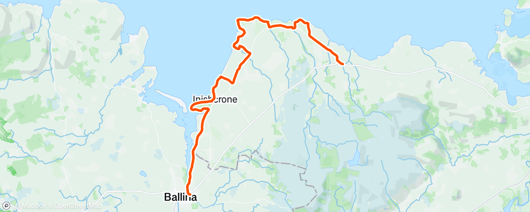
                                Dromore West, Co. Sligo to Ballina, Co. Mayo

                                            Sunday 15 March 2020

                                                48.4 km or 30 miles


Thankfully it was a much nicer day today. I decided it would be more practical to do this run clockwise (or with the sea on my left-hand side) and then get the bus back to Ballina from Dromore West. I am depending on public transport this weekend so I had to make this practical decision. Before I left Ballina, I got talking to Rachel (Manager of Twin Trees Hotel) where I stayed and she kindly donated 50 Euro to Clifton School. Thank you, Rachel! I really appreciated that, as the following day all hotels in the country were closed due to the coronavirus and Rachel (and her business) probably needed the money more than Clifton School.

With Rachel, Manager of Twin Trees Hotel


Leaving Ballina, I followed the river Moy all the way towards the sea. Years ago, I remembered going to a pub along by the river to hear Jazz music on a Sunday morning, but it was very quiet here today.
Leaving Ballina with river Moy on my left
Half way between Ballina and Inishcrone


When I reached Inishcrone, I took a left turn across a field (at the ‘Pig’ statute and the ‘Diamond Coast Hotel’), ran along a stream and circled the whole Golf Course.

The Pig at Inishcrone that was 'possessed by an evil spirit and ate everyone it encountered'!

Eventually I got down onto the beach from the golf course and ran along this strand for miles, with Bartragh Island now so close on my left. 


American couple walking on Inishcrone beach

Keeping our distance - only selfies today!


It turned out to be a beautiful day and even at high tide, Inishcrone was such a lovely beach to run on. I passed the seaweed baths and then along a road and trail after that ….but then the road abruptly ended at the coast! I decided to rough it along here, crossing through fields and climbing under (and over) electric fences! I did eventually find a country road that brought me back onto the R297 road.
A famous writer in 1670 who died from wounds he received in protecting a woman from insults!


I kept running on the main road and after about 3km, and just after the sign for Leaffoney School, I took a left turn at the L6409 at the Cabragh river. I followed this road down towards the coast, taking a left turn towards Pullaheeney Harbour just before the Harbour Bar. 

When I reached Pullaheeney Pier I expected the road to continue along the coast (as it did on the Ordnance map!) but there didn’t seem to be any road north of the pier. I got talking to a young couple in their car and they also wondered where the road had gone! It turned out that some sand and rocks from the sea had covered the road over the years. 
The road taken by the sea!

But still marked clearly on map!
I carried on running over the rocks and after about 1km, I found the road again. When it eventually turned inland, I came to a junction with two left turns. I took the second left not really sure where it would lead to, but I knew it was down towards the coast.  When I got to the shore there was no coastal path but I decided to rough it along the coast. There was a lower cliff shelf that I was able to run on and I carried on along here, reaching the headland at Lenadoon Point. 
Running on cliff shelf at Lenadoon Point

Wild Atlantic at Lenadoon Point


With all talk about the Coronavirus, the term ‘self-isolation’ is being used a lot now. No danger of me catching any virus as I was completely on my own along this part of the Atlantic coast. I think it was at a place called Brownstown, where the Finned River flows into the sea, that I eventually left the coast. It was about 2.30 at this stage and the sign said Easkey was 3km.
Welcome To Easkey (which means Fish in English)

Quiet men in Easkey


I was so glad to arrive here as I hadn’t eaten or drank anything since 9.00 this morning. I stopped briefly in Easkey (refuelling!) but I was conscious that I needed to be in Dromore West to make the 3.50 bus back to Ballina. Just after passing Easkey I took a left turn signposted to Easkey Beach and followed the coast road for a while and then came back onto the R297 again.

Almost there but I took the coast road which made it 9km!
I just made it to Dromore West on time and was one of only two passengers on the bus to Ballina. So now I’ve reached Co. Mayo. With talk of lockdowns on the news it’s hard to know when exactly my next coastal run will take place, but the adventure will definitely continue!   

Monday, 17 February 2020


STAGE 42-44: With Maureen & Brian on Streedagh beach


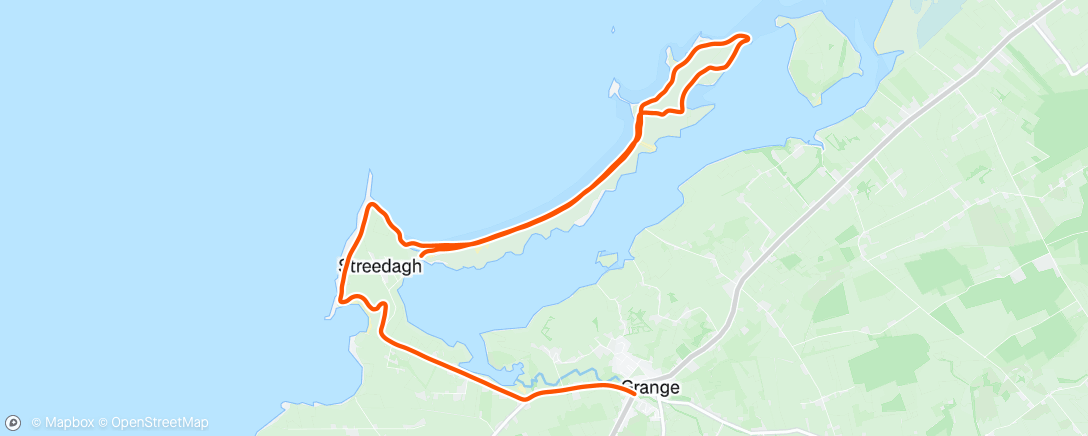
Stage 42: Revisited: Streedagh Beach and Conor’s Island 
                    Saturday 15 February 2020
                            15 km or 9.3 miles

‘’To all the friends who met me there, with hearts so warm and true. To each and all, a fond farewell, sweet Dernish Isle, adieu’’ (written by an anonymous emigrant from Dernish island, Co. Sligo)

My plan today was to tackle Streedagh beach (near Grange) and run along that long, thin peninsula as far as Dernish Island. I knew that low tide was around 4.00pm so it worked out really well in the end as the rain seemed to have died down by then. It had been a mild winter up to now but in the last week there’s been two (named) storms. Storm Ciara bombarded the coast last weekend and this weekend Storm Dennis was doing his best to cause havoc. I did think about postponing my coastal run but, as it was half-term, it would have been difficult. So, on the Saturday, Maureen, Brian and I drove down to Sligo, through the wind, rain and floods. It poured rain all day, but thankfully it was beginning to ease off, just as we were driving into Sligo town around 3.00pm.

View across to Streedagh and Conors Island
We arrived at Grange village and drove directly to nearby Streedagh beach and parked our car there. Maureen, Brian and I then began walking along the strand.

Brian at the Streedagh beach sign


Walking on Streedagh Strand

The three of us walked together the whole way along the long beach as far as the tiny, Blackrock Island. I then carried on running on my own onto Conor’s Island. It's not an island anymore but on an 1837 map it was. Since then a sandbank has connected the island to the mainland. At this stage Maureen and Brian turned around and we arranged to meet later in Moran’s Bar in Grange.
Tiny Blackrock Island on Streedagh Beach
I kept running through the sand dunes all the way along Conor’s Island until I was very close to Dernish Island across the rocks. It was almost low tide now, but it would have been a real struggle to get across those rocks to Dernish. There was no proper causeway to the island and I reckon it would not be very safe to even attempt to cross. In the distance I could see Classiebawn Castle in Mullaghmore and in fact the original site for the Castle was actually on Dernish Island.  
View across to Dernish Island
I turned around and headed back, running on the south side of Conor’s Island. In a field in the distance I spotted about 10 or 12 horses and strangely the animals seem to spot me too! And then I noticed one or two of the horses starting to head in my direction. I sprinted over the hills almost afraid to look behind as the young thoroughbreds chased after me. I was so relieved to be back on Streedagh Beach again.
Surfing at Streedagh despite Storm Dennis


Spanish Armada - 3 ships sunk off Streedagh Beach


Back on Streedagh Strand I couldn’t help reflecting on the historical significance of this area. Three Ships of the Spanish Armada crashed here in heavy storms back in 1588. The story of the Armada seems to be following me all along the Irish coast!

After running along the beach again I followed the headland south all the way around, through fields and mud. Storm Dennis seemed to have picked up again and the wild Atlantic was battling away. I eventually made it back onto the road and soon I was enjoying some Cidona and Taytos (with Maureen and Brian) in Moran’s Pub in Grange!     
Back In Grange in front of Spanish Armada Mural


                            Stage 43


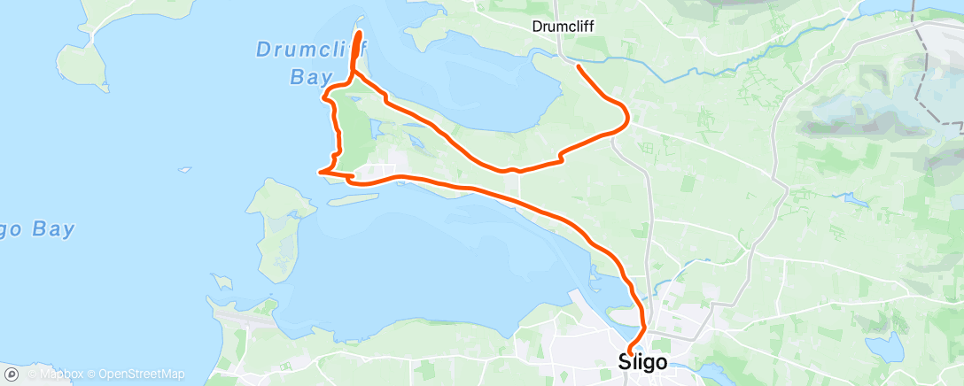
                                Co. Sligo: Drumcliff to Sligo Town

                                            Sunday 16 February 2020

                                                22 km or 14 miles


We stayed the night in the Clayton Hotel in Sligo town. In the morning, Maureen drove me to Drumcliff village, and we paused at Yeats Grave (casting a cold eye, on life and death!).
At Cafe in Drumcliff with Yeats picture

On Facebook, I had put up a message on the ‘Mountain & Hill Running in Connacht’ page asking, if anyone wanted to join me today. Nobody took up the offer, so I headed off, south along the N15. Just after passing through Rathcormack, I took a right turn. There was a dark sky above but somehow the rain never materialised.
I took the 'less travelled' right turn to Lower Rosses.

I followed the signs for Lower Rosses and eventually, as I was getting close to the coast, I spotted a lane (right) that took me down to the shore. I was able to stick to the coast along the long narrow peninsula all the way to the end.
At top of Rosses Point

Trying to stand still!


I could clearly see Lissadell House across the bay and of course Ben Bulben to my right. When I turned around to head back south towards Rosses Point, I faced storm Dennis and the wild Atlantic wind in all its glory. I was lucky I had my hat and snood to protect me from the sand blowing in from the shore. Shortly I reached Rosses Point Golf Course – no mad golfers out today! I kept struggling against the strong wind and to make matters worse, the rain now arrived. However, I could now see the pier at Rosses Point and civilisation.

I decided I deserved a break and walked into the first hostelry I could find in Rosses Point. It was the Yeats County Hotel (YCH). I ordered a coffee and water and headed towards the open fire. 
Waiting for clothes to dry at Yeats County Hotel in Rosses Point
Here I got talking to some visitors from Armagh and they kindly let me dry some of my clothes by the fire while I drank my coffee. When I was leaving, one of them (Declan McAlinden) gave me a donation of £20 for Clifton School - thank you Declan and friends!
Wreck and Oyster Island
From here It was a straight run into Sligo Town - the sign said 8km – but it was still a tough ending to today’s adventure. I continued on, eventually crossing the river Garvoge into Sligo town to meet Maureen and Brian. 
Famine Memorial, Sligo Town
Famine Letter


                            Stage 44


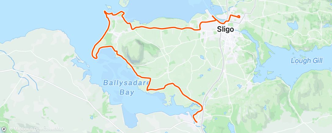
                                Co. Sligo: Sligo Town to Ballysadare

                                            Monday 17 February 2020

                                                31 km or 19 miles


This morning I had an early breakfast and left the Clayton Hotel in Sligo Town about 8.30am. (Maureen and Brian staying in bed). I think Storm Dennis had died down and I only suffered one heavy shower today. 
Clayton Hotel - it used to be a Hospital
Sticking by the coast as always, I followed the dock road in Sligo after I crossed the river. This wasn’t easy and at one stage I had to double back on myself. Eventually, I did get onto to the main Strandhill road and had to run along the main R292 for quite a few miles. 
Start of Killaspugbrone Loop
As I came into Strandhill, I was lucky to spot a sign pointing towards the ‘Killaspugbrone Loop’. This was a lovely path that led me down to the shore and took me past Sligo Airport. 
I followed the coast all the way around and reached the only house in this area. Around the back of the building, I come to a high wall. Once climbing over that, I landed on a beach that I was able to run on. At the end of the strand I could spot some ruins and headstones. 
Ancient Graveyard at northern tip of Strandhill

Killaspugbrone Graveyard


This was the ancient Killaspugbrone church and graveyard that St. Patrick attended and apparently, he crossed over to Coney Island from here. Although this seems to be the closest point to Coney Island, there is actually a proper causeway further east which gives easy access to the island at low tide. 

After leaving the old churchyard I was still able to follow a grassy path to the tip of the peninsula and loop around back towards the village of Strandhill. 
Still following the 'loop' sign!


The wind wasn’t as strong as yesterday, but it was still a struggle! I eventually arrived back to civilisation again and this time I stopped at Shells Café in Strandhill. 

Meeting Brian at Strandhill
Shortly Maureen and Brian arrived, and we enjoyed some coffee and scones in the cafe. Soon I was running again – this time, south towards the sand dunes. As it was high tide there was no possibility to run on the beach. Running through the dunes was a lovely run and brought me around the bottom of Strandhill peninsula. 
Sand dunes - south of Strandhill


Nice soft path to run on


I then came to Colleenamore beach. Not really sand for the feet of the runner as it was too soft. At least the weather has brightened up.


On Colleenamore Beach


I could do with seeing more of these 'You are here' signs!

I left Colleenamore strand and at the top of the road I took a right turn towards Ballysadare, following the R292 for a few miles with Knockrea (Queen Maeve’s grave) on my left.

Knockrea (Queen Maeve's Grave)


This is where you take a turn down to shore
At a sign for a Marian Shrine, I took a right turn towards the shore and then a left just before I reached the coast. There was another rough trail to the right after about a mile, which I should have taken – it would have brought me onto the coast again and probably made my journey shorter. 
10k to go - this seems about right!
In any case I got back on the main Ballysadare road again. At this stage I was struggling – running three days in a row was taking its toll – so I decided to walk the hills. Still, nobody said this adventure was going to be easy – and soon I had reached Ballysadare, my final destination for this weekend.


At last I've reached Ballysadare!

Stage 44: Revisited: Co. Sligo's Coney Island 
                    Sunday 20 September 2020
                            13 km or 8 miles

I knew that I needed a low tide to be able to run (or walk) across to Coney Island and we got the perfect day to do this. I had completed Stage 48 in NW Mayo the day before and I was so glad that Maureen and Brian could join me today on a less strenuous adventure. We arrived at the start of the causeway at 11.30am , about two hours before low tide. Our first reaction was that the tide was still quite high - we definitely couldn’t see any causeway! However after chatting to a few people we quickly realised that it was quite safe to cross in our bare feet and what a lovely experience that was. (much nicer than driving across, especially as we knew we had four hours to return again)
With shoes off before heading across to Coney Island

Coney Island is sometimes called Inishmulclohy. There are a few similar named islands in Ireland as coney or coinin is really the Irish word for rabbit. Apparently the New York Coney Island is called after Sligo’s Coney Island as the sea-captain of a ship called the ‘Arethusa' (that used to sail between Sligo and New York) noticed lots of rabbits on the New York island and it reminded him of Sligo’s Coney Island.

Half way across to island

At Rock no.10 of 14 on way to Coney


It’s a good 2.5km across to the island from the mainland and we had the most beautiful day to do this with Ben Bulben watching over us the whole time. There are 14 (rock) markers about 150 metres a part to guide you on the way to the island. On reaching Coney I put my running shoes on, left Maureen and Brian, and ran clockwise (sea on my left) around the island. I continued along by the shore, first running on soft sand and then on the grassy headland. 

Eventually I arrived at Carty’s Strand on the west side of the island where I had arranged to meet Maureen and Brian again. Maureen gave me a drink here and we watched the horses running on the strand. 

At Carty's Strand on Coney Island

I continued running on my own around the rest of the island, first up through the big rocks and soon I found a narrow grassy path. I could see a lighthouse on my left side (Blackrock Lighthouse) and shortly I came on to another beach on the north side of the island. I ran along the strand here until I came to the pier where again I was reunited with Maureen and Brian. Looking across to Rosses Point we could see the famous Metal Man across the bay (not exactly the Statue of Liberty but he’s still 12 feet tall!). 

Looking across towards Metal Man and Rosses Point

At the Pier on Coney Island 


We still had plenty of time on the island and we were even able to stop at Wards pub for some coffee and crisps for Brian before walking slowly across the strand back to the mainland. It was such a lovely day that will forever live in my memory. Bye, bye Coney Island.