Saturday 17th June
<Author: Gerry O'Boyle (photos by Helen Byers, Gerry O'Boyle and Gavin McDonnell)>
Stage Five: Strangford to Comber (approx 57.5k or 36.4miles)
 We started our adventure today in beautiful morning sunshine in the village of Strangford. We could of course have crossed over on the ferry to Portaferry (about a mile or 8 minutes across) and continued our run along the east side of the Ards Peninsula. However, we decided not to take the easy option as we are trying to strictly stick to the coast.
In fact Strangford Lough isn’t really a lake – it’s actually a salty sea inlet - the largest sea inlet in the British Isles and we’re going to run all the way around it (anyway, it only adds an extra 60 miles to our journey!) The name Strangford comes from the Old Norse word – ‘strong fjord’ and it’s also the original home of King Magnus (bare legs). Magnus would have been very proud this morning to see all the barelegged coastal runners.
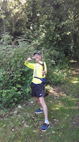
Our core team of three (Helen, Sean and me) were delighted to be joined by a few more runners today. Simon and Keith joined us later in the day but Jill and Sarah – the first runners to come back again for more – started together with us in Strangford. So, it’s ‘Five go for a wee run’ as we set off on a beautiful midsummer’s morning. Yes, the weather is perfect and even at 8.00am the sun is high in the sky and already it feels nice and pleasant at 16 degrees.
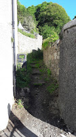
The Squeeze Gut in Strangford
 |
| The Squeeze Gut |
 |
| Gerry and Sean attempt to squeeze through |
 |
| Catapult time! |
 |
| Jill runs through the seaweed |
 |
| Castle Ward |
Of course our own Sean Nickell is very familiar with Castle Ward. It was here he did his ‘Last One Standing’ running event. Sean completed an amazing 25 laps over a 25 hour period recently. I was going to say Sean could do this stretch in his sleep – well, running for 25 hours he probably did actually do it in his sleep!
 |
| Running through the Co Down version of "The Dark Hedges" |
 |
| The church in Saul |
Saint Patrick/Saul
Allegedly, St Patrick died in Saul on 17 March 461 and is buried in nearby Downpatrick. Tradition holds that St Patrick and his companions landed at the mouth of the Slaney River, a few miles from here, in 432AD. Patrick encountered Dichu, the local chieftain, who gave him a barn for shelter. (The word for barn in Irish was Sabhall, from which we get the anglicised word Saul).
After passing through Saul we continue straight (along Mearne Road) until we come back to the main Strangford-Downpatrick road (we don’t actually go into the town of Downpatrick, even though its only a mile way) We cross over the main road onto Quoile Road and welcome the cool breeze from the River Quoile on our right hand side. We run along a lovely coastal/river path and then we make a very sharp turn to the right at the bridge (Bridge over the river Quoile!) - signposted Killyleagh/Comber.
 |
| Helen, Jill, Gerry and Sarah at the river Quoile |
 |
| Bridge over the Quoile |
 |
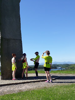
| All 5 at the Delamont millennium Megalith |
 |
| View of Mournes skyline from Delamont Megalith |
 |
| View of Strangford Lough from Delamont Megalith |
 |
| It's a long way up! |
 |
| Sean explaining how the granite is mined |
We continue our run, following the narrow paths towards the shore and trying to find the coastal path to Killyleagh. I’m not sure where we went wrong (and I hold my hand up here–it looked easier on Google maps!) but after running for about 20-30 minutes we somehow end up back at the entrance to Delamont. So, we’re back on the main road again heading for Killyleagh. After about half a mile we take a right turn down Shore Road (which does what it says and eventually brings us to the shore!). We follow the road around until we reach Killyleagh harbour. We then spot a church steeple and the castle in the distance and run up Irish street to beautiful Killyleagh castle /archway where Simon Robinson is waiting patiently in the warm sunshine to join us. It’s now 11.45 and we’ve already covered 20 miles today. Simon has kindly bought bottles of lemonade for us all and we can’t thank him enough for his generosity. In this weather, it’s just what the doctor ordered! I know Simon as part of a ‘Sunday morning Coffee/Running group’. Simon usually takes his lively and friendly dog Otto on our Sunday morning run and now I’m beginning to wish I had four legs to get me through today. It’s warming up now (23degrees) and we welcome our short break in Killyleagh.
 |
| Jill and Sarah leave us at Killyleagh |
Shrigley
Shrigley is just about a mile outside Killyleagh but once was a small industrial village which grew up around the large six-storey cotton mill. In 1836, Shrigley mill had more power looms than any other factory in Ireland. However, I read that ‘’between 1968 and 1972 a very extensive redevelopment project was completed involving the replacement of the early industrial village, the construction of 154 houses and two shops. In short, the village as a village was entirely swept away; not one of the original workers' houses remains’’.
Just outside Killyleagh at Shrigley (after NI Plastics) we take a right turn down Clay Road and continue straight along here. We cross over Tullymacnous road, staying on Clay Road and eventually we come back onto the main Comber road again. We take a left turn on the main road and although there’s no footpath we only have to run for about half a mile when we are able to take a right turn towards the Lough - down Ringdufferin road. We stay on this nice quiet road for a mile or two and then we come to a junction which looks as if it could lead down to the coast. This road is called Ringhaddy Road and this is where it all went wrong!
Yes, Ringhaddy Road did lead down to the coast but when we went to take a left turn at the shore there was no coastal path and just a house with a big gate, saying Private Property! (we noticed in this area a lot of private/no entry signs). We decided to climb down onto the rocky/muddy shore anyway, take a left and make our way along the rough shore, hoping we would somehow get back onto a trail or country road. We struggled along the muddy/seaweed shore for about half a mile and then abruptly came to a fence that said ‘private property, trespassers will be prosecuted’.
So we now had a dilemma – would we turn back on the shore and run all the way back up Ringhaddy Road or would we chance climbing over the fence and risk being prosecuted (someone mentioned risk of being shot!). We had a third option which we also tried (well Simon did!) -this was crossing the muddy bay! Although it was low tide, there was still a narrow stretch of water to cross and lots of mud/quicksand. Simon volunteered to cross but soon was deep knee in mud before he’d even got half way!
We didn’t take this option and decided to reluctantly head back along the shore. However half way back we discovered a small entrance off the shore onto a lane. At this stage we didn’t realise we were on a private lane. Soon the owners of the property confronted us but Sean quickly defused the situation, explaining what we were doing and the landowners let us continue running on their lane. We quickly joined up with Quarterland road and then Ballymorran road (this was the road we should have taken in the first place!!)
We followed Ballymorran Road all the way for a mile or two until we came to a T junction and then took a right turn towards Whiterock. After about a mile we arrived down on the coast at Whiterock harbour. At this stage something seemed to urge Helen on – she perked up and starting talking about beer! I wondered why at first and then realised she could see the ‘promised land’ across the bay! And yes, there it was indeed; less than a half a mile away, Sketrick island and the pub ‘Daft Eddies’.
 |
| After just 28.4miles, we arrive at Daft Eddies! |
 |
| Welcome to Keith "Cheers"! |
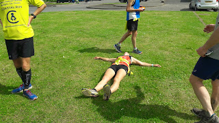
We were now totally exhausted but were delighted to meet two fellow runners (Gavin McDonnell and Keith Gilmore) here to complete the last 7 miles into Comber with us. Not only did they welcome us but they provided us with well-needed fuel (orange juice and snacks) to revive us. After our earlier exploits we arrived an hour or two later than expected at Sketrick island and apologies, especially to Gavin who had another commitment in Belfast and wasn’t able to run the last part with us. Thanks so much for coming to Daft Eddies (and for the refuelling snacks!) Gavin and we know you’ll join us at one of our next stages.
Helen and I had a pint of shandy each and were feeling so tired that we discussed finishing this stage at Daft Eddies. (28 miles seemed enough for one day!) Simon and Sean though were very keen to complete the stage into Comber and Keith Gilmore was rarin’ to go too (although Keith just celebrated his 40th birthday last week, he’s running remarkably well for a man of his age!) Anyway, Helen and I lost the vote 3-2 and so five of us continued into Comber.
 |
| Getting closer... |
 |
| Closer still... |
 |
| We've arrived! |
We seemed to be running for a quite a while when we came across a signpost that said – Comber 6 miles and then after another half a mile another sign said the same, Comber 6 miles. I think I must have hit the wall at this stage – and I don’t think that pint of shandy in Daft Eddies did me any good either – although Helen’s pint seemed to give her a second wind! For the last few miles my legs were so heavy, so it was walking, running, walking ....with Sean urging me on and eventually we arrived in Comber. And so, Stage Five is completed – the adventure continues!
Watch it here
Total distance to date: 189k or 118 miles Next leg: Sunday 23 July (Comber to Portaferry)
If you’d like to Donate to Clifton Special School, please see below. https://mydonate.bt.com/events/cliftoncoastalrun/381290
 |
| "This is the best sandwich I've ever tasted!" |
Watch it here
Total distance to date: 189k or 118 miles Next leg: Sunday 23 July (Comber to Portaferry)
If you’d like to Donate to Clifton Special School, please see below. https://mydonate.bt.com/events/cliftoncoastalrun/381290


